Wednesday, July 31, 2013

31 July 2013 Haven Caravan Park, Coolgardie, Western Australia


We nearly didn't come to Esperance, and certainly the trip in from the west was canned some time ago, more likely to be reached as a side trip from Norseman, if at all. However we are so glad we did come; it has been worth any inconvenience we might have thought of, although I can think of none right here.

Our only regret is that we came in the middle of the foreshore upgrade, and were, as a result, unable to walk along the James Street Jetty with the chance of meeting the New Zealand fur seal who frequents the precinct. We can see that when this work is completed and the revamp of the rail corridor to the port which is also currently disrupting the town’s traffic flow, Esperance will be an even more charming spot than we found on our brief visit.

There is one other regret, one that includes travelling in the entire south west of the state; we are too early for the wildflower season.

We were away from Esperance by 9 am, calling into the newsagent for the newspaper, which miraculously arrives in this remote town by opening time. Soon we were on the Norseman Road, just over 200 kilometres north of Esperance, most of that passing through sheep and grain growing country, and then north of Salmon Gums, about halfway to Norseman, past numerous salt lakes.

Just north of the tiny settlement of Salmon Gums, we saw about half a dozen upturned rail wagons. Subsequent research revealed that these were the remains of a derailment back in late May this year, of about thirty wagons carrying iron ore.

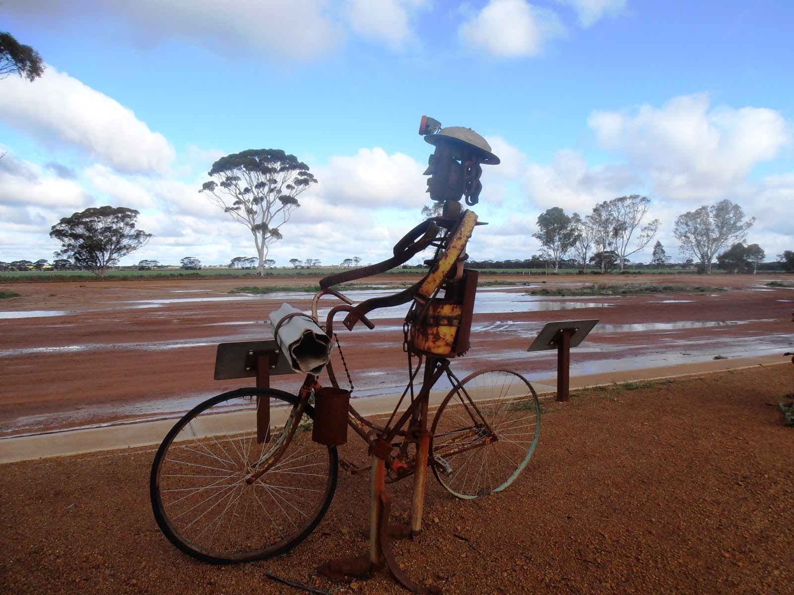
Norseman is the gateway to Western Australia to those crossing the Nullarbor from South Australia, today with a population of about 1,000. The streets are wide, made so for the large camel trains that brought through supplies for gold mining.

Gold was discovered by a horse named “Norseman” in 1894, two years after the first discovery about ten kilometres south of the town. That first discovery and subsequent settlement, Dundas, was established in 1893, and created some competition for Norseman as it too struggled to develop. However with Cobb & Co starting mail delivery in 1899, and later in 1935 when the company, Western Mining, set up operations, monies were pumped into infrastructure; bitumen roads, electricity and an extension of the Goldfields Water Supply Scheme, that with its genesis at the Mundaring Reservoir in the Perth Hills that we explored in our  first few days there.

Norseman was once the second richest goldfield in Western Australia, next to the Golden Mile in Kalgoorlie. It is claimed that since 1892, over one hundred tonnes of gold has been extracted from the area. Today mining continues under the banner of the Norseman Gold Mines, making it Australia’s longest continuously running gold mining operation.

We noted the small old mining cottages as we came in from the south, and did wonder where all the wealthy modern miners lived. Perhaps they are all “fly in, fly out” types?

Today the “caravans” turning in the wide streets were not those of the camel variety, but the same as ours. I have not seen so many caravan rigs and motorhomes travelling through one town, parked up outside the Visitor Centre, for so long. The woman in the Centre was worked off her feet, helpfully advising all-comers, handing out pamphlets about fuel across the Nullarbor, holes on the longest golf course and any other question that arose.

We lunched while in this great cavalcade of caravans, and then headed north, while some headed south to Esperance, others east to South Australia and some like us, north toward Coolgardie.

The road, a further 166 kilometres, passes on up past several large salt lakes, the major ones being Lake Cowan, 160,000 hectares when full, and Lake Lefroy, 510,000 hectares. This latter is widely used for land sailing, considered to be one of the best in the world for such activity, and has been used in the past for Australian land speed record attempts. We had been keen to find out more about this, in fact, to try it out for ourselves. Today that excellent woman in Norseman said she thought the land yachting was on hold over the winter because the lake was now too boggy. We had heard that the yachting was only done on a club basis and had been prepared to sit about and wait for their club days. It would seem that we will have to give it all a miss. I rather fancied whipping about in a Blokart or similar craft. We will pursue our enquiries when we get to Kalgoorlie however are preparing ourselves for disappointment.

The salmon gums were far more plentiful and beautiful north of Norseman than the road to the south. A fellow traveller had recently told me that the “apricot gums” were particularly beautiful on the road from Norseman to Esperance, offering a reason why we should go out of our way to travel to Esperance. She was wrong; it is this road further to the north.

We saw numerous entrances to mine sites, all tucked far off the main road through screens of bush. I later checked their names and found that these had included the Higginsville operation which mines gold and processes the ore from the Trident and Chalice underground mines. At the Miitel Mine it seems that nickel is extracted, so all in all it is a very rich area.

Finally we pulled into Coolgardie, a historic town today with just about one thousand inhabitants. It was once the third largest town in Western Australia, after Perth and Freemantle, when mining of alluvial gold was a major industry.

The town was founded in 1892, when gold was discovered. At its peak, seven hundred mining companies were based in Coolgardie and registered on the London Stock Exchange.

However by the early 1900s, the gold began to decrease and ever since then, the population and industry has slipped and slid away. Today it is a bit of a ghost town, still with beautifully wide streets and some very handsome buildings, catering for the tourists who bother to pause and reflect on its past.

We called into the Visitors Information centre manned by a woman who came from Wales many long years ago, who has retained her accent to such an extent that she is almost impossible to understand. We nodded and smiled in response to her warmth, and left with a town map showing all the historic spots about, all with comprehensive interpretative panels.

We had considered the possibility of staying two nights here, however changed our mind, found our way to this caravan park which is very secondary to the other one more centrally located in the town, however well satisfied with the tariff of $25. We were greeted by a most bogan-like chap at the gate, who directed us to a very convenient drive-through site and then came over and took our money. The amenities are immaculate despite the fact they are situated in old and shoddy looking buildings, including a rather un-level donga style re-locatable structure. But you get what you pay for and in that context, we are well satisfied. The park advertises in the Camps 6 Bible and fits with the standard generally of those who do the same.

We will park back up in the town in the morning and immerse ourselves in its history armed with our little map, before heading north west to Kalgoorlie, only thirty eight kilometres away.

Speaking of distance, it reminds me of an encounter I had with a woman a week or so ago. In Albany, we called into the RAC office to obtain a new map, the old having become rather dilapidated, and I told the young woman behind the counter how we had travelled nearly seventy thousand kilometres over the past two and a half years. To be honest, I was quite boastful. She countered that she had just travelled three thousand kilometres in the past week, popping upstate to visit family. This reminded me that Australians travel huge distances in their daily business and ordinary lives, thinking nothing of it. We have nothing to boast about at all, although I might just mention that we have been indulgently travelling for an extended time, might I not?

Tuesday, July 30, 2013

30 July 2013 Pink Lady Tourist Resort, Esperance, Western Australia


I am sure you are tired of me expressing such childish delight when I see blue sky and sunshine through the caravan blinds in the morning; so be it. This morning was yet another one.
Beautiful beaches of Cape Le Grand NP

We set off for the Cape Le Grand National Park fifty six kilometres east of Esperance. The park covers an area of 31,801 hectares, was established back in 1966 and features amazingly attractive bays with wide sandy beaches set between rocky headlands and inland, an undulating heath covered sand plain interspersed with swamps and fresh water pools. In the south west corner, most accessible on good sealed roads, are several massive granite outcrops, peaks including Mt Le Grand at 345 metres, Frenchman Peak at 262 metres and Mississippi Hill at 180 metres. Reading the brochure I had thought we would scale Frenchman Peak however on personal acquaintance, I decided it was better left for those fitter than I.

We did call into all the beautiful beaches which are linked by a fifteen kilometre long coastal walkway; Le Grand Beach, Hellfire Bay, Thistle Cove and lovely Lucky Bay, where if you are lucky, you will find kangaroos lounging about on the sand or washed up sea grass. Alas, there were too many other tourists about and the roos had moved on, but this could not detract from the stunning scene before us. We chatted with a woman travelling with her husband and four sons; she had taken a photo and immediately posted it to her Facebook page. Her friends had just as quickly responded, accusing her of doctoring the photos. We all remarked that we could understand such a comment, but the colours were indeed true and amazing.

We scrambled around the rocky cliffs above the beaches, as agile as mountain goats if I may so myself. This made me feel a little better about having given up on the mountain climb. Some exercise was better than none.
 
On the way back to Esperance we noted the area’s own Stonehenge situated on lush green farmland just eighteen kilometres short of the town. We were not tempted; we had visited a similar setup just out of Carterton in New Zealand where we had also been treated to an amazing oral lesson in navigation, astrology and history. Perhaps the same is available here too?

The sun was still shining when we arrived back in Esperance so we decided to drive back out along the coast to the west of the town, to revisit the coastal scenery seen in a poorer light yesterday. We drove out as far as the Observation Point, just over fifteen kilometres from the town and were duly rewarded. Today was indeed a far better day to appreciate the coastline, and we were pleased the weather had allowed a second viewing.

Back in town, we refuelled in readiness for tomorrow’s departure, wandered about the town centre and then bought a few stores at the Woolworths supermarket. There are in fact four supermarkets here in Esperance; three Super IGAs and the one Woolworths. One is spoiled for choice.

Even as I write this, the skies have remained clear and we should have a good sunset. Hopefully it will stay fine for tomorrow as we head for Norseman.

Monday, July 29, 2013

29 July 2013 - Pink Lady Tourist Resort, Esperance, Western Australia


The weather conspired against us once more but we were not to be beaten. Our plans for the day were modest, just a short drive around the immediate environs and to explore the town itself.

Esperance has a population of 14,280 and has all the services one might need in this corner of the world. Its history has been up and down as is the case with most places; it’s not a boom town these days, for sure, especially in the middle of the winter.

Like all places in Australia, it has been home to aborigine people for tens of thousands of years, but it is European history that occupies our interest. The very first European to call by was Captain Pieter Nuyts in his ship, the Gulden Zeepaard, in 1627, although he didn't actually set foot on land but did manage to record some flowering plants. He continued on, mapping 1,500 kilometres of the south coast.

In 1792, two French frigates on another mapping voyage of the coast under the command of Admiral d’Entrecasteaux took shelter in one of the sheltered harbours. The first ship gave its name to the bay, L’Esperance, and the second, Recherche, to the archipelago, the great string of 110 islands and 1,500 islets that protect Esperance from the great Southern Ocean.

Matthew Flinders called by a few years later, in 1802, and named some of those islands, and then Edward John Eyre called briefly with his aboriginal guide.

But it was not until 1863 that the Dempster brothers arrived in the area, having come overland from Northam with their families, guides and over 3,000 head of stock, and that was the beginning of agriculture in Esperance and the surrounding area.

When gold was discovered in Coolgardie in 1892, the throngs of miners and support crew came up through Esperance, arriving by ship and so Esperance became an integral part of the gold rush.

However doom was spelled when the rail reached Coolgardie from Perth in 1908, and Esperance became superfluous as a supply port. The town was reduced to a holiday resort and fishing village, with the struggling pastoralists hanging in where possible.

But then in 1956, a consortium of American companies and the Western Australian Government joined forces, under the title, ELD. This became one of the largest corporate farming projects undertaken in Australia. The project was that 40,000 hectares of scrubland would be taken up and made into farmland each year. The proviso was that half the land had to be sold to ordinary farmers within ten years and the other half to American investors. ELD provided forty blocks each of about 1,000 hectares a year. At least 325 hectares had to be cleared and developed for wheat and / or livestock farming. The application of superphosphate played a large part in the new development too.

With the low cost land on offer, it led to a rush of farming settlements in the Esperance district in the 1960s with people coming from all over Australia, Europe and America. The original concept had collapsed just four years after inception, however once the Government became involved, operation continued through to 2003. The success can be measured by the change in numbers of those involved in farming. In 1954 there were only thirty six farmers in the area, utilising about 8,093 hectares. Today there are about six hundred on more than 404,686 hectares.

The forty kilometre Great Ocean Drive is well documented for the tourist, and we headed off in reverse, hoping the weather would improve by the time we reached the coast.

The Pink Lake, not at all pink now, has high salinities as does the Hutt Lagoon we called into on our way south from Kalbarri. The lake covers an area of ninety nine hectares and is home to significant numbers of Hooded Plovers and Banded Stilts. It is just one in a chain of wetlands that circle the town of Esperance, the others including Lake Warden, Woody Lake and Mullet Lake and like the rest of the wetlands, plays a significant role in wildlife conservation.

We drove on through the coastal scrub to the sea, and up to the wind farm, which like that at Albany, is owned and operated by Verve Energy and takes advantage of the reliable southerly winds. The turbines here are smaller and less in number, but no less impressive, standing high above the very beautiful coastline.

Australia’s very first wind farm, the Salmon Beach Wind Farm, was built, here at Esperance in 1987, then was decommissioned fifteen years later. One of the two turbines is now situated in the museum ground, the other in situ as a memorial to its pioneer status.

But the wind farms we called up to today are at Ten Mile Lagoon, nine turbines built in 1993, and a further six turbines at Nine Mile Beach built ten years later, almost a continuation of the first lot. They operate in tandem with Esperance’s gas turbine power station to provide electricity for the town, because remote as it is, Esperance is isolated from the national or state power grid.

We called into the Ten Mile Lagoon, Nine Mile Beach, Observatory Point, and Twilight Beach, this latter voted Australia’s best beach in 2006. These are all very beautiful, all well-appointed with smart access stairs and lookouts, but the further we drove, now heading eastwards back toward Esperance, the clouds rolled in from the ocean and visibility was appalling. Despite that, and even though the photos I took did not reflect this, the sea was a lovely blue, the clear clean water on such fine white sand beautiful even on such a very dreary day.

After about fifteen kilometres along the coast, we arrived at the outskirts of the town, and passed below very smart modern homes perched high above the sea, contrasting with the rather uninspiring homes in town nearer our camp. We stopped at the Rotary Lookout high above the port and town, an excellent place to enjoy 360 degree views on a better day. After Chris refused to walk further afield in the drizzling rain, I suggested we give up on the sightseeing and head to the museum, which we duly did.

The museum has rather abbreviated opening hours and is staffed by volunteers. We were warmly welcomed and ushered into what was previously the town’s original railway marshalling yards, the goods shed and office.

There is a wealth of exhibits in the museum covering every aspect of Esperance’s history, all well labelled although not as professionally curated as that in Albany. Those that particularly stood out for me were:
·         The wreck of the Japanese owned Sanko Harvest, a 30,000 deadweight bulk carrier, carrying a cargo of highly soluble fertiliser and heavy fuel oil, that came to grief on a reef about six miles off Cape Le Grand in February 1991. The ship broke up over the following two weeks and released its cargo into the sea. I am sure I can remember this happening, all the way from New Zealand. 

·         The other feature which cannot but impress are the pieces of space junk, dropped all around the town when the USA’s Skylab space station crashed to earth in July 1979. It was to have come down in the Indian Ocean, but the landing was rather miscalculated. The Shire issued the USA with a fine for littering and that fine was finally paid, in full in 2009, when a radio show host raised the money and settled the account on NASA’s behalf. I do not recall any of this but then I was in Vanuatu with a month old baby. Space junk was definitely low priority.

By the time we emerged from the museum, the day looked a bit brighter, however I was pleased to head on back to camp and settle in to the warmth of our little home. The weather forecast for tomorrow looks promising. Time will tell.

Sunday, July 28, 2013

28 July 2013 - Pink Lady Tourist Resort, Esperance, Western Australia


Today we managed to avoid the showers, evident on the horizon and by the deepening puddles and usually dry lakes we passed as we travelled south east to our destination.

We had initially thought to travel to Hyden via Lake Grace, however our alternative route has taken in other lakes; there are so many in the area. In fact there is an absolute chain of lakes all the way south along the highway to King Lake and beyond. I imagine that many of these lakes, some very large, are more often than not, just dry salt beds; today there was water in most, visible from the road.

While all the cropped land about us seemed to be on a relatively flat plain, we had in fact climbed over the past few days. At Kulin we had been at 309 metres ASL, at Hyden 285 metres ASL and on reaching Lake King, 344 metres ASL.

Lake King, like Hyden, was settled in the 1920s as part of a Settlement Scheme, as so much of this corner of the country seems to have been. Then there were 3,400 farms involved hereabout, but the Great Depression and the salinity of the land drove so many away, and now there are but a fraction of those landholders or their descendants left, although their holdings are so much larger. As we drove south we found very few entrances to homesteads which seemed to support that there are few actually living on these vast areas of canola and grain growing, although there must be some to keep an eye on the sheep, most at some stage of lambing.

At Lake King, Varley and Mt Madden, all sporting massive grain storage facilities, there is no rail. Presumably the grain is reloaded and trucked to the railheads or perhaps to the port at Albany or Esperance?

 
At Varley we passed the “Rabbit Cemetery” which caused much speculation, and then chuckled when we saw another road sign advising motorists to “wave safely”.

At Ravensthorpe, we reached the South Coast Highway and parked up in an information board bay; time for lunch. We were soon joined by a double-B train all the way from Deniliquin, NSW. The driver hopped out and let his two sheep dogs out from the empty crates. We watched as they ran around like mad things and then came and sat quietly listening to their master, rapt with his tone as he spoke quietly to them. They were all a very long way from home and we wondered what they were up to.

Ravensthorpe has a population of 400 with a further 1,140 living out in the adjacent countryside. There is still cropping and sheep farming going on, but most of the countryside, in fact, two thirds of it all about, is wilderness, protected by National Park or Reserve status. The location won mineral wealth status back in 1871 when gold was discovered by sheep farmers. Further discoveries followed in 1900 which resulted in a short boom, when the population of the place climbed to 1,000, and by 1901, the government gazetted the town of Ravensthorpe.

The government completed construction of a copper and gold smelter a couple of kilometres south of the town in 1906, used to cast copper and gold ingots. At the peak of production, there were over one hundred and twenty men employed, but now there are only ruins to show for their enterprise. The town’s population grew to 3,000 by 1909, but soon the First World War took away the labour and by 1918 the copper smelter was closed, along with most of the mines.

A couple of kilometres north of the town, we noticed a sign to a mine at Mt Cattlin. We learned that this is a spodumene project; tantalum and lithium oxide as we had seen up at Greensbushes, north of Bridgetown. Galaxy Resources exports the spudomene to China, presumably starting with a road trip to sea ports here on the south coast.

To the east of Ravensthorpe, we saw the Nickel Operations, a mine and hydrometallurgical processing plant, lying a couple of kilometres to the south of the highway. This was previously one of BHP Billiton’s operations, but is now under ownership of First Quantum Minerals subsidiary FQM Australia Nickel Pty Ltd, after controversial financial problems.

The road across from Ravensthorpe to Esperance, a total of 186 kilometres, is far more up and down than those travelled over the past few days, but does have a number of passing lanes so we were able to be passed or pass slower traffic. There was little traffic anyway; perhaps that had something to do with the fact it was Sunday.

We pulled into Esperance a little after 3 pm, hoping to catch the Information Centre before they closed. Alas, they close at midday on Sundays, but do have a comprehensive list of caravan parks and their tariffs on the window, and so we came on to this camp, prompted by the fact it was one of the two cheapest after our Family Parks loyalty discount.

We have booked for three nights, but are open to extending. I have not mapped out our days here yet, but will attend to that over breakfast tomorrow. It seems we have chosen well, however there are notices in the amenities about keeping everything under lock and key. It would seem there are thieves about; whether they dwell in the camp or the greater area is uncertain. We shall take good care of our few valuables, such as they are. Television reception is good although internet is less so. Still, we did manage to converse with my parents on Skype before we sat down to dinner and before they headed off to bed. It would seem that all is well in our world, and theirs.

27 July 2013 - Wave Rock Caravan Park, Hyden, Western Australia


 I am sure the farmers of the wheat belt woke happy this morning, happy to hear the rain still falling gently upon the land. While we empathised with the farmers, we were not as happy with the prospect of sightseeing yet again through a veil of rain.

I was regretful that we had done yesterday’s journey so little justice. Narrogin had been but a refuelling spot for us but could have offered so much more in better weather. Here there is the Dryandra Woodland that offers walks and the sort of education we enjoy, but not in inclement weather.

Kulin apparently offers spectacular shows of wildflowers in the season. Here the flowering gum, eucalyptus macrocarpa, a particularly beautiful tree is the emblem of the town. Kulin is also the beginning of the Tin Horse Highway, a celebration of the Kulin Bush Races, which are held in October every year, and beyond. Through the driving rain yesterday, we had noted two very colourful tin horse sculptures beside the road, obviously part of this artistic trail.

Before we left our excellent little caravan park in Kulin, Chris sat crunching the numbers with his log book in hand and discovered that the landcruiser’s performance yesterday before refuelling at Narrogin, had been abysmal; a mere 4.7 kilometres per litre, in fact the worst ever performance throughout our entire travels.

We drove on up through the rain, the road through from Kulin to Kondinin following an old railway line, overgrown with weeds and in some places sagging into the salt lakes we passed. Checking the map, I decided that Kondinin’s grain silos must be unloaded into trains coming south from Narambeen, before or after they travel on east to Karlgarin and Hyden. Once the whole of this region was networked with rail, now so many of them are closed.

We passed fields of blooming golden canola crops, and even more golden flowering Australian wattle growing beside the road, the great litter of Paddy or Ghan melons strewn on the bare muddy edge of grain crops and flooded drains, sometimes reaching across part of the road. Already there was evidence of ground saturation and that if it kept on coming down, there might be floods rather than welcome irrigation. Traffic approached us with their headlights shining; Chris reckoned they were not used to driving in the rain hence the overkill of safety precautions.

The small towns we passed through were as uninspiring as those passed through yesterday; rain mist and rain drenched towns, puddles and the absence of people tend to convey that image.

As we approached Hyden, we were overtaken at speed by a big white ute with “Ngati Porau” plastered across the rear windscreen; we spent the next five minutes trying to remember where that Maori tribe were most prevalent. I thought we might ask the driver if we caught up however I suspect he had reached Norseman or Esperance before we pulled into Hyden.

There, at Hyden, we saw a crowd of school girls gathered at the side of the netball courts; play was proceeding despite the rain. We found the newsagent, doubling as the post office, the supermarket, the scrapbooking shop and half a dozen other small shops in the same complex, a welcome refuge from the rain staffed by a delightful young woman who informed us the Weekend Australian would be in on Monday. We settled for the Weekend West which had only had to come from Perth.

A couple of kilometres to the east of the town, we pulled into the Wave Rock resort. The caravan park is run in the same way that Kings Canyon or Uluru are, except there seems to be no aborigine benefit here. Our reception was faultless, friendly and informative. We were handed a bundle of useful information and asked for $38. We had considered we might spend two nights here, however learning the tariff, we decided we would make do with one.

We set up and had lunch quickly before heading off to do all that we might otherwise have taken two days to do. Fortunately the showers had cleared, for the moment.

We drove sixteen kilometres north from Wave Rock to The Humps and Mulka’s Cave, most of the road sealed with just the last couple of kilometres deep slushy slippery mud. We started with a visit to Mulga’s Cave, where we saw some of the four hundred and fifty separate handprints and images on the walls, the largest collection of Aboriginal paintings in the south west of Western Australia.

The exact use of the cave is unknown, however the cave gets its name from a legend style story which serves to warn people from breeding across family barriers, a rather gory story. The aborigines have a complex set of relationship taboos, which basically guard against incest and inbreeding. The rules have been explained several times in museums; however I cannot begin to get my head around it all. The system is apparently successful, because they managed to survive for fifty thousand years or so in an isolated part of the world.

There we set off for the two walks on offer, the Kalari Trial, 1,670 metres up and over the granite humps standing high above the plains of grain and salt lakes and then 1,220 metres through acacias, rock sheoaks and sandalwood bush, the Gnamma Trail, named for the rock waterholes or gnamma. While the rain had ceased, water continued to stream down over the rocks, showing the colour of the geology at its best. At the summit, we lent into the wind and lower down that same wind whistled through the sheoaks, sounding like waves crashing on a rocky shore. Beautiful natural gardens grew in basins of earth and rock, bright with colour, all quite incongruous on the otherwise bare rock.

On the flat ground around the granite outcrop, we jumped across flooded temporary streams and stepped around full waterholes. These same waterholes when empty can seem devoid of life, but when it rains a dramatic change comes over them. These basins burst into life as seeds, spores and eggs lying dormant in the mud hatch and multiply. Crustaceans such as fairy shrimps, seed shrimps, water fleas and clam shrimps breed quickly in the warm shallow water. Tadpoles and then frogs feed on them, attracting birds, lizards and snakes. The circle of life resumes. Today we could hear the frogs but as usual, not catch sight of even one.
Glorious flora on The Humps

The Humps are one of four major rock ‘islands” in the Hyden area, the others being Wave Rock, King Rocks and Graham Rock. All four are “inselbergs” or island mounts. Being massive blocks of granite with few open fractures, they have withstood the weathering action of the wind and water and are now left towering above the softer more erosion prone landscape around them.

The small patch of woodland around the Humps is dominated by huge old salmon gums, the same we have admired along the side of the roads travelled today and most of yesterday. They are such graceful trees particularly when they stand in isolation along the road side. They generally do not grow to more than twenty five metres in height, yet are the tallest trees growing in the eucalypt woodlands of this area. Their presence alerted farmers to the quality of the soil; they do like the best to grow in. It is also interesting to note that their tap root often extends as far below ground as the tree is high.

Satisfied with our brisk walks through this bonus site, one we had not been aware of before our arrival in Hyden, we set off along Woolocutty Soak Road in search of the Rabbit Proof Fence. The receptionist at the caravan park had alerted us to its whereabouts and we were keen to see it for ourselves.  The State Barrier Fence South Section, or Rabbit Proof Fence, was originally erected between 1901 and 1907 in a desperate attempt to hold back the advancing masses of pasture eating bunnies, making their way across from Victoria. The fence is located between Starvation Bay, east of Esperance on the South Coast, to the Ninety Mile Beach, east of Port Hedland, spanning a distance of 1,827 kilometres. It used 1,800 tonnes of materials in its construction and in addition to this, posts were cut from the adjoining bush wherever possible. It has long since fallen into ruin, and it was with some difficulty that we did in fact find a remnant back from the road.
One of Hyden's many artworks

We headed back into town, to refuel with diesel. On check-in we had been given a 4 cents-a-litre discount voucher for the Liberty Fuel outlet. There are three fuel retailers in this little town of 500 people, and we were keen to check prices before cashing in on the voucher. Liberty’s price was $1.71 a litre, another independent outlet had his diesel at $1.70 and the unmanned BP pumps were almost ten cents cheaper again. We did not fall for the Liberty sales trick and filled instead at the electronic pumps, taking a lot longer to do so as we worked our way through the directions.

We spent some time near the railway station, admiring a series of artworks constructed from scraps of metal and off cast rubbish, all very clever and offering a serious commentary on the history of European settlement of the town and surrounds.

Hyden was only settled in the 1822, although surveyors, sandalwood cutters and gold prospectors had passed through before. By the end of World War I, Kondinen was already an established town, and by 1920 farms had been taken up as far east as Karlgarin. The first blocks in the area were taken up by men who generally worked part-time at clearing their land while they earned a living on more established farms further to the west. As cropping gradually became more established, the arduous trek to Kondinin to deliver bagged grain became just too hard, physically and economically. The Old Kondinin Road was just terrible and transport was far from reliable. Consequently, bagged wheat was stock piled in Hyden, pending the arrival of the much sought after railway line. By the time trains finally arrived in 1932, there were 60,000 bags of wheat waiting to be shipped out. I do wonder how many years of harvesting these represented and what the life is for a bag of wheat!

Today farmers still struggle with their existence here across the Belt, battling climate and economic change, but then that is the way of agriculture. Today, Saturday 27 July, they were happy, with the rain and celebrating with a sports tournament in town; netball, hockey and AFL football with those down from Bruce Rock.

In the late 1950s the Hyden Progress Association began to explore ways of catering for the increasing numbers of visitors coming to see the unusual wave-like formation carved out of the flank of Hyden Rock. Wave Rock attracted international interest when a photograph of it won a major competition in New York in 1964. The photograph was reprinted in National Geographic and the rest, as they say, was history. Little further promotion was required.

From the local tourism committee grew the Hyden Tourist Development Company, a locally owned organisation which now employs more than seventy local people. The motel was built, and subsequently upgraded; the roadhouse came next, followed by the caravan park at the Rock and then the Resort. In 1998 the new airstrip was opened delivering just some of the 140,000 visitors who come to Hyden each year.

Next it was time for us to see what we had come for; Wave Rock. We returned to the caravan park, parked the landcruiser and set off on foot on three of the available trails; the Wave Rock Walk, Hyden Rock Walk and Hippo’s Yawn Loop, completing the last stage as the afternoon was winding up and the ring-necked parrots and galahs were circling ready to roost.
Chris walking beneath The Wave

The geology of Wave Rock is very much like that of the Humps, and as impressive. Here however is the Hyden Dam, right up on top of the rock, which supplied the town’s water supply right up to the year 2000. Wave Rock, a granite cliff, striped spectacularly with algae, is over 100 metres long and more than fifteen metres high.  In 1960, crystals from Hyden Rock were dated as being 2,700 million years old, amongst the oldest in Australia. Actually that is a fact that makes my eyes glaze over too; rocks are old, that is just a fact.

Back at the caravan, we patted ourselves on the back; we had done everything we wanted to at Wave Rock, albeit at high speed, and we could move on again tomorrow. However it must be said, that while this park is exorbitantly priced, it is very nice; modern, immaculate, really without fault. Yet one should not overlook the fact that there is a $7 per vehicle fee to view Wave Rock, so perhaps the all-inclusive tariff of $38 is not so bad after all? And the long detour trip has been worth every litre of diesel.


Friday, July 26, 2013

26 July 2013 - Kulin Caravan Park, Kulin, Western Australia


That cold front arrived in the early hours of the morning bringing heavy rain, which continued on and on after we crawled out of bed this morning. I watched as our neighbours packed up in the hideous conditions, both clad from top to toe in bright yellow rain wear  They did not appear to be enjoying themselves much, and I dreaded that it would soon be us going through the same motions. However, joyfully, the rain desisted and we managed to stay dry while we broke camp and headed out of Albany.

Fifty kilometres north of Albany we arrived at Mt Barker, a small rural town of about 2,760 folk, neat as a pin and surprisingly full of relatively modern buildings. The administrative centre of the Shire of Plantagenet was settled soon after Albany, however it was not until the rail came through in 1889, that Mt Barker really took off. Today it is an agricultural service centre. We drove in and out of the town and on up the Albany Highway enjoying the lovely pastoral scenes sometimes interrupted by viticulture.  The Porongurup Range stood clearly to the east, impressive but alas, neglected by us. As we continued north, the Stirling Range was barely visible, the tops of the peaks, especially Bluff Knoll, shrouded in heavy rain cloud.

At Cranbrook, where we noted for the first time today, but now for the last, the grain silos and loading facilities adjacent to the rail, we turned north east and took the Great Southern Highway which runs along the Beverley – Albany rail. Soon the rain set in and we were met not just by the strong winds which had been buffeting the caravan but by driving sleet, or sleet-like rain. Visibility was appalling and we proceeded at snail pace, lights on and crawled into Katanning.

We had been keen to visit Katanning, for several reasons; one being that it is regarded as the centre of the Great Southern region and the other for the curious fact that it is home to many people from Christmas Island who settled in the area after finding work at the local abattoir. This means that most of those immigrants are Muslim, which has facilitated the Halal slaughter of animals at the abattoir here, thus enabling sale to Middle Eastern markets. Given the on-going controversy about “boat people”, illegal immigrants to Australia, particularly in the last week with the new or resurrected Prime Minister fiddling on the fringes, I found this all quite fascinating. I imagined a number of hijab clad, if not burka-clad, dusky women about their business in a very Australian country town and perhaps the minaret of a new mosque. Perhaps it was because the weather was so terrible and all these new Australians were wisely staying indoors, or perhaps it was because these people have all integrated into local society; but I saw no evidence of a Muslim society here, although we did see a takeaway food caravan operated by Mohammed someone, selling Malaysian food and being patronised by a very blonde, very Caucasian looking woman. Perhaps to a past resident, Katanning might seem very changed; to us it looked like any other Australian country town on an absolutely crappy day.

It should be noted here also, on the subject of the demise of animals, that Katanning is home to the largest country based sales yards for sheep sales. Just as we visited the cattle sales yards in Gracemere, just out of Rockhampton, one can watch from a special viewing platform, sheep being sold here every Wednesday.

We cracked open a can of ham and pea soup for lunch today; it was that kind of day. Over lunch we discussed route options, Chris having done considerable research last night, something he normally leaves to me. Option 1 had been to travel on from Albany to Esperance, up to Norseman, pop on up to Kalgoorlie, back to Norseman and across the Nullarbor. Option 2, which arose just a few days ago, was to travel from Albany to Wave Rock, then on to Kalgoorlie, down to Norseman, then a side strip, or not, to Esperance, then across the Nullarbor from Norseman. I had been pressing for Wave Rock for some time however acknowledged that it was an awful long way to travel just to see a rock. It seems however that the seed had been successfully planted and my wish was to come true. We are, after all, now on our way to Wave Rock although the route beyond is still undecided. I was therefore happy to agree to Chris’s suggestion that we continue north to Wagin and Narrogin, rather than cut across through Dumbleyung and lesser roads. A small compromise for getting my way after all.
Bart

Wagin is yet another service centre for the sheep and wheat farming carried on in the region. It did not come into existence until the Great Southern Railway was completed, the town proclaimed in 1898, nine years after the railway was completed. It suffered flood devastation in 1934 but today is a fine well established rural centre, watched over by the largest ram in the Southern Hemisphere, according to the tourist promotional literature. 

Chris and I frequently chuckle about Australian’s superlative description of their icons, although we did think that Wagin’s fibre glass sheep might be bigger than Gouburn’s Merino. So I subsequently did a little research and came up with the following:
·         Wagin’s ram, who is named ‘Bart”, and was constructed in 1985, is nine metres tall, thirteen metres long and six metres wide and weighs four tons.
·         Goulburn’s Big Merino, nicknamed ‘Rambo” by the locals, is fifteen metres tall, constructed of concrete and was erected in 1985.

By my simple deduction, the Big Merino wins hands down, but then perhaps, Rambo is female, a ewe? This would make Bart the biggest after all. Or perhaps the ‘biggest” relates to fibre glass structures only? The truth is that no one counts on silly tourists actually doing the comparisons.

In March each year, Wagin holds one of state’s largest agricultural shows, regularly attracting over 30,000 visitors; another superlative.

It  also has the second hand shop where we purchased a bag of golf clubs for the princely sum of $50, in anticipation of playing the longest golf links in the world. As we pulled out of Wagin, Chris did question whether the clubs were in fact for right handed players, and then decided, it didn’t really matter, because we would be equally handicapped if they were not. Later we discovered they were regular clubs, that the bag also contains tees and a small raggy towel, but no balls. We will have to track some down before the first tee-off.

We pressed on up the Great Southern Highway to Narrogin, rain falling from the heavens in response to the passionate prayers of the drought stricken grain farmers of the Wheat Belt. Narrogin is considered the commercial centre of the Wheatbelt South. It was also where we left the major highway and a good place to replenish our diesel tanks which were seriously depleted.

We turned onto the Williams – Kondinin Road, heading east on this recently upgraded road. The road continued over the gently rolling country, as it has all the day, although the grain and canola growing paddocks were larger than those further south. There were still many flocks of sheep, the young lambs far whiter than their mothers, and many still very new.

By the time we reached Kulin, we had covered three hundred and ninety two kilometres and Chris was yawning more often that I thought safe for a driver to do so. We pulled into this very modern camp ground and called the caretaker whose telephone number was advertised on the side of the ablution block. She soon arrived, collected our twenty five dollars after explaining the camp had been here for just three years having replaced the derelict one on the other side of town. Most people probably only stay the one night, on their way to or from Wave Rock. We are still about ninety kilometres away from Hyden where the rock and surrounding geological wonders lie; we should reach there tomorrow morning. In the meantime, the rain continues to fall and we are snug inside, glad to have the electric heater blasting out some warmth.


Thursday, July 25, 2013

25 July 2013 - Big4 Albany Gardens Holiday Resort, Albany, Western Australia


Our last full day in Albany dawned clear and cold, although not nearly as cold as a dozen other centres shown on the weather map around the country today. We set off with lunch packed in the eski, although we had no plan to travel very far afield.

Today was the day to immerse ourselves in Albany’s culture and history, to date only dabbled in. First stop was the Vancouver Art Centre, barely mentioned in the tourist publicity and for good reason, as it turned out.

The Centre is housed in a wonderful old building, or series of buildings, formerly the Albany Cottage Hospital, built in 1887 and alas, today falling to bits at the edges. Damp is creeping into the exterior block work and there will be pleas to the council for funding before long. After the hospital vacated the premises in 1962, it served briefly as a school hostel and holiday accommodation, before a major refurbishment program began in 1980 before the transformation to its current status.

Today the centre was busy with arty crafty people; spinners were busy spinning in a large activity room, fans of an artist all the way from Japan were enjoying a morning tea and chat from the artist herself, and her works, minimal and uninspiring as we found it, was in two very small rooms to which we were directed by the delightful receptionist. This same charming young woman invited us to join the morning tea and to wander about this wonderful old building in an attempt to spot the odd artwork exhibited. We thanked her but I could not bring myself to gate crash the tea party, however we did enjoy exploring the building even if the artworks were scarce. The Centre is essentially a meeting place for people who have artistic aspirations and should not, and does not, promote itself as a gallery.

From here we headed to what we thought was the Albany Museum, which turned out to be only a part of a group of attractions that together make up the town’s Cultural and Tourism Precinct, a fact I found later. Had I done my homework with the usual diligence, we would have approached this from a different perspective.

We pulled into a parking area beside a very old collection of buildings and found the reception area, tucked away and manned by a friendly man whose first language is German. His English is so peppered with his mother tongue that it is almost unintelligible to the partially deaf middle aged antipodean. We nodded and smiled and waited until he waved us on through to the beautifully restored Albany Gaol.

This really is worth the modest entry fee, with excellent stories all about.

In Western Australia the approach to convicts was unlike that of New South Wales and Tasmania, in that it was based on the concept of rehabilitation. The convicts that were brought to Albany in the brig, Amity, were carefully selected for their skills and trades, with a view to settling the area. They came here to establish the first European settlement in the western part of the continent and built a small outpost here more than two years before the Swan River Colony, now Perth, was established in 1829.

Those first few arrived in 1826, although it was not until 1852, the goal, as it is today, was built. The Old Gaol began as a Convict Hiring depot and in 1873, it was extended to perform as a public gaol.

There are stories of ghosts who lurk about the premises, the story of the murderer Frederick Baily Deeming, who was thought incorrectly by some to be the Jack Ripper, who passed briefly through the gaol before being executed for his hideous crimes and the one hanging at the gaol of William McDonald in 1872. There are a number of manikins in the cells and in hammocks to echo the poses and places of those past, the kitchen well set up for the baking of three hundred and fifty loaves of bread per day and the laundry with the irons all lined up on their racks above the wood stove.

James, the German, had made himself understood to us, in so far as directing us across the rail to the rest of the museum and the Amity toward the sea.The rigging of the Amity beckoned us across the precinct, and we walked the gangplank to find there was a separate entry fee for this, which included an audio tour courtesy of a brick-style cellphone thingy, a description you need to be of a certain age to comprehend. We braved the cold wind on deck and the cramped quarters below decks to absorb the facts and experiences of that voyage all those years ago.

The vessel on display today is a full size replica of the original Brig Amity, built in the mid-1970s to mark the 150th anniversary of the brig’s arrival. The original vessel was built in New Brunswick, Canada in 1816. After some years as a trader she sailed to Hobart and in 1824 was bought by the Colonial Government in Sydney to assist in supply and exploration.

In that same year, the Amity transported convicts from Sydney to a short-lived penal settlement at Redcliffe, at Moreton Bay, Queensland. After bringing Major Lockyer and the settlement party to King George Sound in 1826, the Amity paid two more visits to this struggling outpost, bringing much needed supplies.

The Government sold her in 1831, and for the rest of her sailing days, the Amity worked as a trader, whaler, sealer and transport ship. In 1845, she was wrecked in a storm off Finders Island, near Tasmania, a sad end for a tidy little ship if the replica is anything to go by.

Nearby is the Albany branch of the WA Museum, the reception area, a shop, a small exhibition about the lighthouses of this southern coast and an art exhibition of aborigine artist Jimmy Pike. We had seen some of his work in a Geraldton art gallery, most already marked with “sold” stickers suggesting that Mr Pike was at last going to be a wealthy man. Today the work did not appear to be for sale and was of a simple nature, done with felt tips. I suggested to Chris that a school class of ten year olds might come up with work of a similar standard however he drew my attention to the skills Jimmy Pike has as a colourist. Alas, I am such an ignoramus!
Replica of the Brig Amity

The exhibition about the lighthouses was very small but very interesting, including the basket which was used to haul people and supplies up from boats to the keepers on Eclipse Island south west of Albany. Those keepers and their families were staunch folk, living a harsh life long after so many of us had the comforts of modern life.

We dragged ourselves away, lunch appealing to our hunger, but then became distracted by the centre piece of the museum, which in fact we should have started with. The main museum exhibits are housed in the Residency and is as wonderful as any we have seen. We should have spent much longer there however our hunger drew us away and we did not do this museum justice at all.

However in the rather brief and cursory visit, I did learn that the lands inland of Albany were settled as were those to the west of Albany, through Group Settlement Schemes. Each family received a hundred ans sixty acres of thick forest, swamps and snake infested country. I had read earlier that these farmers had struggled with the poisoning of their domestic animals, not by resentful indigenous peoples, but by the unknown vegetation often the only diet after drought or flood.  

There were in fact fourteen different varieties of toxic plants on offer, and it was not until 1841 that botanist James Drummond discovered the toxic nature of a number of native peas, almost all restricted to the south-west of Western Australia. Around thirty of the one hundred species are known to be poisonous, and some of these are associated with stock poisoning. The key ingredient of the poison found in the leaf tips and the seeds, was identified in 1944 as sodium fluoroacetate, now marketed as the infamous 1080. The poison is highly toxic to some animals and humans, but many of the native fauna of the south-west have a natural tolerance to it. These days it is used in Australia to help control feral animals including rabbits, foxes and cats. In New Zealand, it is used to control feral animals such as ferrets, weasels, cats and possums.

Albany’s geographical location and importance as a coaling port has periodically thrown the town onto the national defence stage. As mentioned earlier, it was here that the fleet set off with Australian’s contribution to the war effort in 1914. The refuelling of those ships with coal was one of the major factors, and interestingly it was not coal from Collie just “up the road” that was railed down, because that was not of sufficient quality for such purpose, but coal shipped from Westport in New Zealand, part of which was probably dug out by my rellies, coal from Newcastle in New South Wales and more from just out of Wollongong in the same state.

The port provided the same service for the American “Great White Fleet  in 1908, the final departure point for Boer War troops in 1899 and was  home to part of the US submarine fleet in 1942.

This role dates back to 1853 when the Peninsular and Oriental Company stationed the old sailing ship and convict transport Larkins in Princess Royal Harbour. It acted as a floating coal storage facility, or “coal hulk”, to service the new steamer service. The Larkins was the first of twenty three coaling hulks at Albany owned by various competing companies.

Albany experienced a rapid burst of growth in the late 1880s. Gold discoveries brought large numbers of people to Western Australia. Albany was the point of entry for many diggers heading to the goldfields and the source of their supplies for the fields. The opening of the Great Southern Railway from Beverley to Albany in1889 added to the prosperity.

The 1950s was again a turning point for Albany and its Port. Agricultural and pastoral production increased. Harbour works began in earnest with dredging and reclamation work and a new transit shed. Three land-backed berths were opened in 1955, 1957 and 1971. Bulk handling facilities were introduced in 1956. The number of ships using the port increased with a wide range of exports as new trades emerged and some, such as whaling and trawling, disappeared.

The number of cruise ships visiting Albany has grown in more recent times. Grain, timber products, including woodchips and later logs, became increasingly important as the Albany Port moved into the twenty first century.

With this wealth of information, heads exploding again as they always do after a trip to a good museum, we sought refuge in the land cruiser down at the water front. Lunch was most welcome but even more, the bonus of the day; a couple of dolphins swimming across the harbour within our immediate view.

We could have returned to the museum, or museums, as we were fast learning, but instead chose to take some exercise. We drove along the shore toward Middleton Beach and Emu Point, and pulled into the car park at Lake Seppings. I had noticed this several days ago when we drove out this way and stored the “Bird Walk” for possible future activities.

The walk is just 2.7 kilometres and circuits the lake incorporating a lookout, bird hide and a boardwalk, from where, if lucky you may see some of the 107 bird species who apparently inhabit this wetland. We set off through the melaleuca thicket along a muddy pathway, dismayed to find so much of the vegetation laid waste. Soon it was evident that the storm that had caused damage when we were at Walpole had wreaked havoc here too. Since then, maintenance men had been through with chainsaws, clearing the way for keen walkers, but leaving the waste strewn beside the path.

Lake Seppings has had an interesting history and it is quite miraculous that it is today a reserve for nature lovers to enjoy and home to so many birds, long necked turtles, bandicoots, snakes, et cetera.
In 1888 the lake was declared a Botanic Garden, in 1900 the lake was called Albany Park and protected as a natural wetland. Then somewhere between 1900 and 1970, the lake became a rubbish tip. In 1972 the Department of Fisheries and Fauna recommended the lake became a waterfowl reserve, then oddly the Albany Council investigated the possibility of discharging treated sewerage into the lake.

The amazing saving of this lake came in the 1980s when the Apex Club of Albany started work on the Bird Walk. In 2000 the community suggested the lake be protected and restored and in 2004 the circuit walk was restored.

I would like to think there will be no more stages of this metamorphosis, that we are now all sensible enough to recognise how important these sort of places are and how they need to be conserved, but who is to say. Life is full of contradictions.

We met an old chap walking around the lake in the opposite direction to us, with his very friendly sheep dog; he warned us of another weather front fast approaching the region, and then as we passed him on the opposite side of the lake, he told us we had missed the bandicoot on the side of the path. Lassie had no doubt frightened it off for the week; the old chap was just so full of good tidings!

Before heading back to camp and taking down the awning in case of possible night storms, we shopped at the supermarket and filled up with diesel. We are now all set to leave in the morning; hoping the northerly wind will have turned. The current situation does not bode well for fuel consumption.