Tuesday, November 29, 2011

30 November 2011 - Belair National Park Caravan Park, Adelaide, South Australia


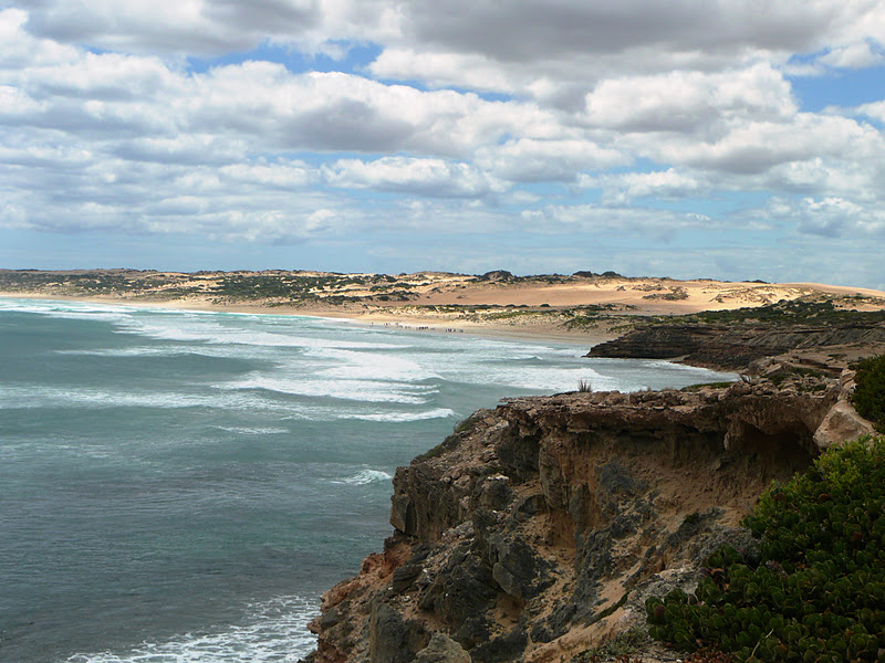
Monday night was a disturbed night what with the wind coming up fiercely in the night prompting Chris to go out and lower the awning at some god forsaken hour, and then the rubbish truck coming on to the airfield at about three making a hang of a commotion as it up-ended the jumbo bin. I woke again sometime after and heard rain on the roof and wondered what had happened to the weather, forecasted to be partly sunny for the next week.

By the time we ventured out to make the most of the day, rain was still threatening but came to little more. We had set aside the day for exploring Gawler’s own attractions rather than those in the outlying areas. The self-drive tour of the city looked promising so we started off from the Information Centre as instructed, turning left, then right, then right and left, and then a detour here or there to view this old house and then that, all of which now seemed to have been converted into rest homes for the elderly or infirm. So much concentration was required to follow the written instructions and to drive the maze of twists and turns, it all became less than fun when one of the roads we were supposed to take was closed off for work and we were unable to re-join the route. We gave up in frustration and decided instead to visit the museum.

This is situated in the old Telegraph Station in Gawler’s main street, sharing part of the premises with a flower shop. Alas the museum part of the building was closed for renovations and had been since 1 November. So that was the end of that.

We had also fancied visiting Gawler’s Art Gallery apparently housed in the old Railway Station, but where was that? We popped into the SAA (South Australia Automobile Association) to pick up maps for the rest of the state and Victoria if possible. The woman behind the counter was very friendly and helpful, however not able to tell us where the old railway station was. So we returned to the Information Centre and found the brochure advertising the merits of the art works on display and telling us that the gallery was open Thursdays to Sundays. So that was the end of that too.

We returned to the airfield, popped in to the office to see Peter, the office-dog’s-body, to pay for the four nights already spent and the one to come, chatted a while with him until hunger drove us over to the caravan, whereupon we unpacked the eski and ate our ready-made sandwiches which had been destined for a more exciting dining location.

The afternoon was spent perusing maps of Adelaide, choosing our next camp, and preparing an experimental fish pie using a can of mackerel instead of smoked fish which is my norm. Strangely, smoked fish does not seem to be available here. We have a couple of times purchased what is sold as such in the delicatessen at supermarkets, and while it has been very pleasant, it lacks that real smokiness that one expects. As far as cans of smoked fish go; they simply do not exist! Perhaps this will change when we reach Melbourne; perhaps it is only Victorians who like New Zealand style smoked fish here? Anyway, the canned mackerel was successful, so much so that it will become a repeat on the menu.

While all this inside business went on, outside the wind came up again and hail passed in a short sharp shower. This morning we learned that the same violent gusts had been instrumental in fanning wild grass fires in the state, one up the coast at Port Augusta and another at Gladstone. The only Gladstone we know is that up the Queensland coast so obviously there is another we have yet to become acquainted with.

The wind continued to blow all night, in through the vents and other apertures behind the microwave and fridge. We huddled in our bed hoping for summer to arrive, however in the end just rose and dressed for the colder weather, packed up camp and set off south to Adelaide.

The capital city of South Australia is just forty three kilometres south of Gawler, and reached by busy roads through suburbia. We had examined the city map in an effort to understand the layout of the city, one where Chris briefly spent time working in back in a past life. It is a well-designed city with a population of just over 1.2 million (very roughly the size of Auckland in population).

Our Tomtom led us through the centre of the city, alongside the green belt of parks and gardens and then south to Belair, situated on the lower slopes of Mount Lofty. The camp is privately owned but adjacent to the Belair National Park, and so the wildlife is the same in the caravan park as the national park. Strange to say, the birds have no concept of legal boundaries.

Once we were set up and had lunched, I did a couple of loads of laundry, and then Chris and I set out up the road to find the Belair Railway Station, showing on the map to be just on the edge of the national park. Although we had driven in this way, we had not been aware how far up the hill it was, and so, when we reached the railway station, we found that it wasn’t just a quick hike to catch the public transport, but a major part of one’s daily exercise regime. If we were to spend our days walking about the city enjoying all the attractions, we might well end up too exhausted. We checked out the limited car parking area, and decided to recheck our maps when we returned. On doing so, we saw that there are two other railway stations closer which hopefully will have better parking facilities. We will check this all out further tomorrow when we set out to utilise the free public transport for oldies between the hours of nine and three. This means that Chis will travel free at least one way, and discounted on the return. It will be the amusing situation of asking for a senior and an adult; me being the only adult.


Monday, November 28, 2011

28 November 2011 - Adelaide Soaring Club. Buchwelde, Gawler, South Australia


We woke Saturday morning to continuing dreary rainy weather and decided that this was not a day to go exploring the wonders of South Australia. We did however venture into Gawler, this bustling town of 20,000, and walk up and down the street to find out what it had to offer besides wonderful old buildings and equally wonderful people, well, at least among those we had encountered to date.

We returned to camp with fresh bread for lunch and spent the rest of the afternoon reading, preparing the next day’s dinner for crock pot cooking and at five thirty, glued to the television. We were absolutely delighted to discover that ABC 24 News was broadcasting all the TVNZ’s election coverage. We were expecting to have to pick up internet updates from time to time, but this was a real bonus; we watched as the progress results were reported and the commentary delivered. I was shocked, as were the rest of the New Zealand voters, to see that Winston Peters and his New Zealand First colleagues had won positions in parliament on the wing of a “tea party scandal” as did Peter Dunne and his United Future unexpecting candidates on the strength of the television commentary “worm” those few elections ago. How interesting the New Zealand parliament will be: perhaps as interesting and entertaining as the circus in the Australian House of Representatives this past year.

Sunday morning we woke to much improved weather, clear skies and less wind. We roused ourselves and were away before ten, heading toward the Barossa Valley. We travelled first to Lyndoch (population 1,430) and walked around this charming village full of al fresco cafes, gift shops, antique shops and galleries, adorned with flowering roses and charm, and then on to Tanunda (population 3,725), Greenock (population 685), Nuriootpa (population 4,414) and Angaston (population 1,865) and finally Bethany (population 80) before passing back through Tanunda and back to camp.

The Barossa Valley was initially surveyed by a William Light who lent his name to a small settlement too small to be mentioned in the list above, in 1837, and by 1847, Herr Klumpp, one of many German immigrants who fled religious persecution in their homeland, had planted the vines at Jacob Creek at Rowland’s Flat between Lyndoch and Tanunda. He set up the wine company, Orlando Wines, (Orlando being the German version of Rowlands) and the rest is history.

Jacobs Creek or Orlando Wines has an excellent Visitors Centre, opened back in 2002. Set among many hectares of parklands, where they are bending over backwards to please the environmental brigade with solar panel banks, native plantings, destruction of “weeds” such as olives (!!), the centre offers a function centre, a restaurant, tasting and sales, and a well set out information “museum” promoting their product and detailing the history thereof. We called in with the intention of buying a souvenir bottle of wine as one just has to when touring this very famous region, however on reviewing the blurb regarding the attributes of their wines, decided that these were not for us after all.
Jacobs Creek is just one of the many vineyards in this entire area, some small boutique holdings and others on a much grander commercial scale.

At Tanunda, we spent some time wandering up and down the charming main street, with all the other Sunday visitors, purchased a book from a second hand bookshop celebrating John Betjeman’s England, (having established that he is a rather distant cousin of mine, I felt I could do no less) and established the exact route of the heritage driving route with the woman in the Information Centre.

We drove along Seppeltsfeild Road, lined with date palms planted to create another income for unemployed through the 1930’s depression, past numerous vineyards from Marananga to the huge setup at Seppeltsfield. We stopped and walked up to the Seppelts family mausoleum on the hill overlooking the vineyards, marvelling at the ostentation. We drove on looking for somewhere to park and enjoy our picnic, and finally found the recreation reserve at Greenock, where half the local population had gathered to play in bouncy castles and picnic together. We found a spot under trees in the shade, away from the people noise, but among that of a variety of raucous birds and satisfied our hunger.
Seppelts family mausoleum

We then drove on to Noriootpa and stopped at the huge industrial complex of the Penfold’s winery, with even more determination to find a wine to suit our tastes. As with all these places, once the professional staff have started pouring the taste tests into the beautiful glasses and expounding their virtues, it would be ignorant to walk out empty handed, and so we decided on a couple of bottles that were acceptable; a shiraz cabernet and a Riesling, both available only here at the cellar. The first was enjoyed with yesterday’s beef casserole and the other has been put away for Christmas.

We detoured off the heritage trail to Light’s Pass to investigate the two spires seen from the main road, and found, as expected, that they did indeed belong to Lutheran Churches. Nearly all of these small settlements have two to three Lutheran Churches, having at some time or another broken free from the first, and then sometimes the second, Lutheran congregation. By all accounts, the people of the Barossa Valley are still very religious and conservative, however apart from the number of churches about, we saw no particular evidence of this.

As we drove the last of the figure eight loops the heritage trail made, we came over the top of Mengles Hill and stopped at the sculpture park, walking among the sixteen works of art, the first created in 1988 and the last eight in 2008, with a wonderful backdrop of the beautiful colourful field of vineyards, grain and settlements lying below.

It is indeed an amazingly beautiful area, an absolute gem in this lovely southern state and no surprise that it is so famous as a tourist destination.

As we drove along the edge of the airfield, we watched gliders ready to be towed and those that had recently landed. It had been a good day for flight unlike the two before.

This morning we set off once again in an attempt to tour the rest of the Barossa Valley, the ranges about and the Eden Valley. Our route began on the same exit out of Gawler but turned south east toward Williamstown, calling into the Whispering Wall. This is a rather tantalising name for the curved concrete dam wall at the Barossa Reservoir, this 140 metre long wall was constructed in 1902, and as such was the first of its kind. Apparently if one stands on one side of the valley and whispers quietly against the wall, the secret will be heard across the other side by placing one’s ear similarly against the wall. We took their word for it.

On through Williamstown, population 1,431, home to several cellar doors and associated vineyards, and of course the inevitable delightful ancient buildings all still in use.

From here we travelled east, twenty kilometres across the range, here beside Mount Crawford which actually does not stand out much against the other elevated land about. Most of the agricultural landscape was either pine forest or cattle grazing land, with patches of vineyards. All distances between these settlements are relatively small (nine to twenty kilometres or so) especially when compared to the vast distances between settlements we have travelled though over the past six weeks.

At Springton (population 330), we headed a few kilometres north to a lookout from where we looked all about and over the Eden Valley. Like the Barossa, the Eden Valley was settled initially by English immigrants closely followed by German’s, most escaping religious persecution. They cleared their land, but only enough to allow their sheep and cattle to graze, and to plant modest vineyards, to build their houses, churches and shops.

Frau Herbig's first home
Springton is particularly famous for the story of one of its earliest settlers, Friedrich Herbig, who arrived in 1855. He was thirty when he married his teenage bride and brought her to their matrimonial home, the base of a gnarled gum tree. There they lived until after the second child was born, when they moved into a new homestead across the road. Frau Herbig went on to have a further fourteen children who in turn produced fifty one grandchildren for these pioneers. The Herbig family have set up an informative display in the tree and one of the descendants has written a book about the family. It would be interesting to read; perhaps I shall come across it one day in a book sale.

After spending some time reading these interesting tales, we drove south west to Mount Pleasant (population 593) and on to Birdwood following the Torrens River, that which finally flows through Adelaide before reaching the sea. Mount Pleasant is famed for its annual role in the Sprint Auto Parts Rally SA, but for us it was yet another quaint old settlement to be passed through.

At Birdwood, we found the recreational reserve, took out the eski and our deck chairs, and sat under gums serenaded (if squawking can be considered a serenade) by galahs and cockatoos. Then we drove back into the centre of this attractive little settlement and parked by the National Motor Museum. This museum is Australia’s biggest motoring collection and has over 300 vintage, veteran, post war, classic and modern cars, commercial vehicles and 100 motorcycles. It is nirvana for most males (and the rare female) and I encouraged Chris to go off and enjoy it all, leaving me to read in the shade. I spent the first hour consuming the newspaper, disappointed to see the only mention of New Zealand’s election a small column on page three of the business section, relating to the possible investment of New Zealand’s state assets by Australian banks. The second hour was spent with my head in the book I am currently reading, Bill Bryson’s treatise on western domestic history, that is, of the home. I am so enjoying it but rarely have the opportunity to spend more than the minutes before I fall asleep. And so we were both spoiled this afternoon; I with my literary immersion and Chris in finding the first car he ever rode in, the car he learned to drive in, the first car he owned, the cars his father owned, the cars he himself owned and those we had together including our Audis and the Mitsubishi 380 we sold before setting off on this big adventure. 

We returned to Gawler via the hills, travelling through more livestock farmed lands dotted here and there with vineyards, cherry orchards and alpacas, descending the range to the south west of the city, called in to Coles and loaded up the shopping trolley with enough to earn ourselves an eight cents a litre discount on fuel and returned to the airfield, finding ourselves still the only campers here.

Friday, November 25, 2011

25 November 2011 - Adelaide Soaring Club, Buchfelde, Gawler, South Australia


Rain fell most of the night, consistent but not heavy. In the early hours of the morning, I wondered in my half asleep state how we would manage to exit from this camp on the slippery slopes of red mud. I decided to convince Chris that we sit tight for a day and enjoy a quiet day reading and writing. But after breakfast Chris ventured out in the drizzle to inspect the first part of the descent down to the creek and came back confident that there would be no problem. I hastily did all the jobs I had been procrastinating, and we were off. A heavy foot as we attacked the hill out of the park, a fishtail slide and we were out on to the gravel road. If they were any parts still clean on the rig last night, they no longer were now.

We headed south to Gawler, just over fifty kilometres away, passing through Malalla, with a pub and the inevitable grain silos. We had set the Tomtom with the co-ordinates for our planned camp and soon found ourselves on a motorway heading for Adelaide but apparently having arrived home. It turns out that the roads have been changed over the last two years and the access to the airfield has totally altered. We reset the Tomtom with the road name and eventually found our way here.

There are two other caravans here, however they are not occupied and so we are effectively the only residents on this airfield. The club house is well patronised however all members have gone home at least until tomorrow. The rain has eased but not disappeared altogether. The forecast is not a whole lot better for tomorrow so we doubt there will be any gliding tomorrow when one would expect more action, it being Saturday.

We set up here, then had soup and toasties for lunch, it being that sort of day. We then headed into the Information Centre, discovered that there is a cinema here and that “Red Dog” was showing at 2 pm. Not only was it the right sort of day for a hot lunch, but a day to pass at the movies, so we made our way to the town’s lovely cinema and enjoyed this excellent Australian movie. We both enjoyed it very much; a moving touching depiction of a true story set in the 1970s in Western Australia. It is a two handkerchief film and requires a dash to the Ladies immediately on exit to correct one’s eye makeup.

Gawler is a very pretty well established rural town established in 1839, thus being the State’s earliest country town. We glimpsed the magnificent architecture and lovely well established trees, particularly the deep purple flowering jacarandas, and look forward to exploring it in better weather. We had indicated to the office person here that we would be staying three nights, however it seems that we will be able to undertake our travel of the Barossa Valley and at least the northern Adelaide Hills from here, rather than have to stay for too long in a city motor camp.

Back at camp, Chris washed the rig in a cursory manner, being careful to minimise use of water, and we managed to contact Larissa who is currently suffering terribly with a crippling back problem. We were pleased to hear her cheery voice which did alleviate some of our concern.

24 November 2011 - Rocks Reserve, near Hoskin Corner, South Australia


As I start this, the sun is still shining low on the golden hills about us, the birds are readying themselves for the farewell chorus and there is not another human or animal in sight, except for the two of us. We have indeed found ourselves in a very private camp.

We broke camp this morning at Maitland and drove up and down the main street slowly to enjoy for the last time, this pleasant little rural town, before heading north west toward the Copper Coast settlements. It is only thirty five kilometres up to Moonta, all across the rural grain lands, all golden in the bright sun, with the clear blue skies as a backdrop. This Yorke Peninsula is truly spectacular especially to those who appreciate rural scenes.

Moonta was indeed a surprise even though we had done our homework and realised that the copper triangle as it is known arises from the discovery of copper in 1860 here and the subsequent mass arrival of Cornish miners, swelling the population in the 1870s to 12,000, making it then the  largest town in South Australia apart from Adelaide.

Moonta
Here at Moonta, much of the mining town is heritage listed but it is also the town itself that is frozen in time; the charm of the old buildings, all in use and a delight to the eye. We called in to The Cornish Kitchen and purchased two of their famous Cornish Pasties which we have since eaten for dinner, meeting all expectations. We called in to the Art Gallery where there was an exhibition of art works by the local school pupils, all of which was very good, some quite brilliant.

We drove into the heritage village hoping to visit the museum but found that it was not going to open until early afternoon and we hoped to be further on our journey by then. As we had been told at the art gallery, all tourism attractions and services in the town are manned by volunteers.

Moonta museum, still closed
We did see the remnants of the water reservoir, the concrete sides of a tank that once held 4,800,000 litres of water. Prior to this, householders had carted their own water and stored it in their own underground tanks where errant children frequently drowned. This larger public facility put an end to that. Apparently the caretaker of the reservoir had a small dinghy he used to clear any rubbish out. 

We drove on down to Moonta Bay which is now just a continuation of Moonta proper, and admired the immaculate residences en route. Down at the water, keen fishermen were out on the jetty, braving the wind. We admired the scene, the shoreline and the caravan park right on the water’s edge, then returned to the rig and headed north to Wallaroo, the port from where both copper and grain were shipped. By 1923, with costs skyrocketing and copper prices sinking, the copper mines and related processing industry was closed down.

 We did hear that grain is no longer shipped from here and yet there is still great evidence of the area still being used as a depot at the very least. Here, as all over the peninsular are large banks of grain silos at these collection depots, all belonging to Viterra who obviously has a monopoly on the industry. Or perhaps this is a brand name for a farmers co-operative? According to our informants at Minlaton yesterday, grain is now only chipped out of Port Giles and Port Adelaide, and yet we actually saw it being moved my conveyor belt onto a ship at Ardrossan. We also were told that much of last year’s crop is still sitting in storage waiting for shipment. Who knows where the truth lies in all of this?

Another rural scene, grain fields forever
Here at Wallaroo there are the partial ruins of the smelter, stores and refinery. The informative displays for this are still a work in progress which explained why I managed to get us lost looking for a picnic place. The waterfront is in the throes of development, a marina taking form and the facilities for the plebs currently taking second place. In a few more years this should be a top class resort. But even now, this and Moonta Bay are already popular holiday destinations.

From here, once lunch was over, we headed just the nine kilometres east to Kadina, which was even a greater surprise than Moonta had been. Kadina is the largest town on the Yorke Peninsula and really has all the services one would need to stay and not head for Adelaide. We drove on through and continued east through Kulpara and on, finally joining Highway One at the top of Gulf Saint Vincent before reaching Port Wakefield.

The flat land crossed to reach this small settlement is sandy and barren but for the saltbush. Gone were the manicured grain fields and we wondered how far these poor lands stretched.

Port Wakefield is noted in the tourist literature as being a must stop and see so we did, driving through it about three times having lost the exit due to road works. It truly is old and was absolutely deserted, suggesting a film set in waiting. We did not linger but left the main highway and headed east a further twenty five kilometres to Balaclava. We passed huge depots for grain, stored both in silos and ground bins, close to the rail, with lines of trucks waiting their turn at the weighbridge. The land returned once more to grain growing with some sheep and cattle, the latter being few.

At Balaclava, we parked and wandered about. Here too are old buildings, all occupied with business in one form or another, and people were buzzing about with their business. While Balaclava lacked the tidy charm of the other towns passed through today, it did seem to be the most active.

Our camp earmarked for the night from both the CMCA bible and the Camps 5, the latter which showed it to be only a day stop, was not much further on, and soon we found ourselves turning on to a gravel road. Chris was not pleased that his Chief Navigator had directed us to this dirt when he had just recently managed to clean both cruiser and caravan from the dirt gathered on our run down the middle of the continent. However we were both delighted with the reserve when we arrived, driving down into a gully of rocks and trees, with a chain of water holes which are the base of a sometimes creek. I think it is a lovely place.

Wednesday, November 23, 2011

23 November 2011 - Maitland Showgrounds, Yorke Peninsula, South Australia


The thermometer managed fifteen degrees on first viewing this morning, and would not have risen much more than a further ten during the day. The skies were clear and it was a good day for a drive, a long drive.

With the eski packed and warm clothes on, we set off south from Maitland, pausing in this lovely little  town centre to buy a newspaper and then headed off on a dot-to-dot 370 kilometre trip taking in Port Victoria, Minlaton, Warooka, Corny Point, Marion Bay, Warooka (again), Yorketown, Edithburgh, Port Giles, Stansbury, Port Vincent, Ardrossan then back to Maitland.

Port Victoria is on the east coast of the peninsula, situated on the Spencer Gulf and was until 1949 the port from which grain was shipped by sail to Europe via Cape Horn. We were quite astounded to learn that sailing ships were still in use as cargo vessels that late in the piece. Today the town of less than five hundred, is a small quiet little holiday resort for keen fisher folk or those who like to get away from it all. The wide main street runs down to the wharf and both Chris and I were reminded of Raglan on New Zealand’s west coast just out from Hamilton.

Wardong Island and the small peninsula that runs down from the north is an aboriginal reserve. Apart from a long winded tale of “dreaming” and the fact that a permit is required to visit the area, we were unable to ascertain whether anyone actually lives there now, ever has done or what is actually there. We do know however that along the coast here, there are at least eight shipwrecks which told us that the area was a challenge even to the experts.

We drove through endless fields of grain crops, golden in the light. Soon we reached Minlaton, the “Barley Capital of the World” and shrine to Captain Henry Butler. On entering this lovely rural centre with less than a thousand occupants, we were greeted by a red Bristol monoplane housed in a large glass cabinet. This is just part of the Butler memorabilia and history attached to this man who is somewhat a legend around here. He was born in Yorketown in 1889, was a farm boy who had a yen for engineering and air flight, made his way to England and soon made his name as a aircraft mechanic and a pilot and then an instructor. He was a show off entertaining the crowds with his aerobatics and “firsts”. He was the first man to fly over the Gulf Saint Vincent to the Yorke Peninsula, the first to do aerial photography, the first to deliver airmail over water in the southern hemisphere. In 1921 he married, a year later he had a hideous accident and died eighteen months later after numerous operations and reconstruction. Poor wife!

But it actually was the barley and agricultural stories than entranced us more. The women in the Information Centre were a mine of information and happy to hand us a pile of brochures to ensure we did our homework. And so from their instruction and stories we learned:

Barley is Australia’s second largest grain crop and the most common grain crop grown on the Yorke Peninsula.
  • Wheat, canola and oats are also grown here on the peninsula.
  • Faba beans, field peas, lentils, lupins and vetch are other crops grown for rotational purposes but are also grown for export.
  • Australia grows approximately 85% of the world’s supply of lupins – 90% used for stock food and aquaculture with only 4% for human consumption.

Marion Bay
Chris had spotted a bakery up the street so we popped in and bought some high calorie treats to go with the sandwiches waiting for us in the eski. These we consumed when we arrived at Corny Point, but inside the landcruiser out of the wind.

Here and on the more southern part of the peninsula, as with the eastern side we later travelled, there was much more sheep grazing than grain growing. There were also more trees left on the landscape whereas further north large expanses had been cleared for cultivation.

Marion Bay was not unlike Port Victoria and Hardwick Bay, although on the southern extreme of the boot-like base of the peninsula. Its charm is in the quiet isolation and lack of sophistication. Quite different to the seaside settlements up the eastern side of the peninsula.

Wattle Point Wind Farm
Edithburgh sits north of the Wattle Point Wind Farm, one of the largest wind farms in Australia, with fifty five turbines generating enough to supply 52,000 homes. This seems to be more effective than solar power however just as unreliable because the generation depends upon weather conditions. Since we have been here in Australia there has been much controversy regarding the health effects of wind turbines, so much so that a couple of states have put a hold on the further construction of them until further research is done. I suspect those concerned about such matters are the very people who are against coal power stations. This would appear to be a no-win no-win situation.

This most southern seaside town as those further north, is most likely more appealing to the city brigade that no doubt pop across the Gulf from Adelaide. The houses are more up to date and the facilities more in line with what modern cosmopolitan folk would wish for in such resorts, however simple.

Rural scene
At Ardrossan, we drove up to the lookout on the side of the dolomite quarry worked by BH Iron, from where we had a lovely view over the township, the quarry and a very distant view of Adelaide, and then headed west again back to Maitland.

It has been an excellent day and while it has been a whistle stop trip, we feel that we have made a satisfactory effort to see the Yorke Peninsula, except for those places on the Copper Coast which we will checkout tomorrow morning before heading away and east.

Tuesday, November 22, 2011

22 November 2011 - Maitland Showgrounds, Yorke Peninsula, South Australia


We woke to the chorus of birds about; kookaburras, crows, rosellas, galahs and a host of others too numerous to identify. We were first out of this road side camp and drove up out the gully to find that we had been only a few hundred metres from views over the coast and Spencer Gulf.

Port Germain is a small settlement on the Gulf, with little but an old jetty to commend it. At 9 am, there was no sign of life but for a parked car and a distant form at the end of the jetty, no doubt trying his luck with a fishing rod. Once upon a time, this jetty was, at 1.7 kilometres, the longest wooden jetty in the southern hemisphere.  Over time, storms and lack of resources have shortened its length, however in the cold wind this morning it was still too long for us to bother walking its length. It is quite astounding how many times we have encountered the longest jetty in the southern hemisphere. One in Hervey Bay springs to mind, and another in Tolaga Bay on the East Cape in New Zealand. Port Germain, with just 250 odd inhabitants,  is an RV Friendly town and has an excellent dump station and water supply that we availed ourselves to. However three quarters of an hour was enough in this coastal place and we were soon on our way again, heading south to Port Pirie.

Port Pirie is just twenty seven kilometres south on the coast, of course. It is the sixth most populous “city” in South Australia with less than 15,000 people, which tells you a lot about population density in this State. It is home to the world’s largest lead smelter and has most services you would expect in a place of this size.

Our main target here was a caravan service centre, the only one within cooee in the region. The proprietor of Northern Caravan confirmed that they were certainly in the business of checking out caravan bearings but were absolutely overwhelmed with work at the moment. "How many days were we going to be in town?" he asked. After learning that we were not wanting to hang about, he managed to slot us in then and there.

So we left the caravan there while we walked about the town, which does have some lovely old buildings along the town frontage, and the quaintest dwellings dating back to pioneer days by the looks of them, all beautifully maintained or restored, or at least that part we could see. Nearly every house has a fifteen metre aerial for television reception, however now that analogue television is obsolete in this part of the country, these too are obsolete. These curious structures are really quite an eyesore to the city-scape, and are likely to stay so for some time. The council obviously agrees with me, as well as acknowledging that some are becoming rather unstable as the materials are disintegrating. But the residents are not in a hurry to dismantle them, because they must be taken down with the strictness of safety precautions, by appropriate technicians. You can understand that no one wants to fork out for this. They may well remain as part of the horizon for some time yet.

The Visitor Centre is also the location of the town’s Art Gallery where we viewed two exhibitions; works grouped under the title “Four Seasons” by Nita Beard, most of which reminded me of two dimensional embroidery samplers, with little sense of scale or perspective and the other a collection of paintings by Jason McArthur who has spent his life working with racing dogs in all facets of the industry. These charming but poorly executed works illustrating dogs at work and on the couch at home were as colourful as Nita Beard’s work, and had a cheering effect. Neither deserve the accolades and pecuniary reward they have apparently received, but they did prove to be a diversion to us who had time to fill.

NyrStar Smelters offer tours three days a week, and as usual, we were here on the wrong day. But then reading the health brochures about lead exposure and how best to live in such an environment, I was not really too excited about staying longer than we needed to.  The biggest percentage of the lead smeltered here is used in the manufacture of lead acid batteries; the kind also used in the storage of solar energy. All very environmental, of course!

The caravan man gave us a call while we were still eating our lunch at McDonalds (where else?). We returned, paid up and considered that we should have had this done about five thousand kilometres ago to save ourselves the cost of full bearing replacement. After topping up with diesel and fresh fruit and vegetables, we were once more heading south through wide stretches of grain growing. The wheat harvest is in full swing and we saw machinery and trucks about in every direction.

We travelled on south through Crystal Brook, Redhill and Snowtown, all marked by huge grain silos and little else. At Snowtown we left the main highway and headed south west down the northern part of the Yorke Peninsula. After 164 kilometres, travelling all the while through grain growing lands, even across the hills high and windy enough to house dozens of modern electricity wind mills and those forming the spine of this peninsula, we arrived at Maitland. Note that this Maitland should be differentiated from the Maitland we stayed at in New South Wales, temporary home to my great great grandparents.

This Maitland has a population of just over 1,000 people, is laid out in radiating squares apparently in the same fashion as Adelaide, but on a miniature scale. It  has a hospital, at least two churches, parks, sports grounds, a school, and of course these showgrounds which provide an excellent camp for us in the way that only showgrounds can. From here we will explore the areas west to the Spencer Gulf, south to the Investigator Strait and east to the Gulf of St Vincent. The weather forecast is good, although the temperatures are according to the caretaker here, inclemently cold.  The wind has deterred us from putting out the awning but given that our time here is really for touring, it won’t matter too much.

21 November 2011 - Port Germain Gorge, South Australia


Last night we sat eating our dinner in the caravan with kangaroos grazing so near, and the noisy crows making their presence felt. I had no regrets that we had come to the Wilpena Resort rather than camp at least thirty kilometres up the road at the Dingley Dell Campground. Mind you, there is no saying whether the roos would have been as quite as populous at that camp.

This morning we packed up and filled with the rather dubious water available, then headed off out of the park. We had during our stay, being using water on board for drinking and cooking, and that from the few taps in the park for washing, however we decided that since there were no warning signs about regarding the water, we would take a punt and use it to refill our tanks.

The forty kilometre trip over the rolling hills to Hawker was as lovely as it had been coming in. Today we passed a large flock of sheep being driven along the wide roadside reserve, hopefully toward the woolshed for some well needed shearing. At Hawker we purchased today’s newspaper (it is always so satisfying to buy the  newspaper on publishing day – a treat I would never have considered so before travelling in the outback where papers are always several days old)  and three screws for the caravan hubcaps at a mechanical workshop. I had suggested to Chris he try any engineering workshop for these replacement screws, but he had insisted we would only be able to get them at an engineering supply outlet. He was proved wrong, but not so surprisingly; these country workshops need to stock all sorts of spares given their isolation. He was however disgusted to pay $2 per screw!

We continued retracing our route south across the Willochra Plains to Quorn, where we pulled into a small shady park for lunch. Chris had the wheel hubs repaired before I had lunch on the table, and we were soon on our way again, but this time taking a new route, south east and still travelling across the flat lands of the same plains. The grazing land use however gave way to cereal crops, and great expanses of yellow stretched far out as far as the Horseshoe Range which ran parallel to us in the east.

Soon we arrived at Wilmington, an immaculate small township originally called Beautiful Valley by the pioneers who settled here in the mid-1850s. The town boasts both a toy and puppet museum, however neither particularly interested us. There are also some interesting looking walks and drives about, however we were more interested in travelling on rather than  discover the further delights of this settlement.

Views over the beautiful valley
Another twenty three kilometres on and we arrived in another quaint and very tidy town, Melrose, the oldest town in the Flinders, established in the 1840’s with the discovery of copper. The town is tucked at the foot of Mount Remarkable and unlike the three other settlements passed through today, well-populated with trees if not people. Today it has pubs, accommodation, a very small general store and a bicycle shop, all catering more for the tourist rather than the locals who probably travel through to Quorn or Port Augusta. There are numerous cycle tracks and walks around (including the Mawson Cycle Trail and the Heyson Trail) so we imagine that this place is abuzz at better times of the year when cyclists or walkers are less likely to perish from the heat. Having said that, the temperatures today have been pleasantly cool, around thirty or so, but then anything these days for us under about 34 degrees is considered relatively cool. We spent some time wandering the hundred metres of township and then climbed the lookout hill above the town to the War Memorial, from which we enjoyed panoramic views over the plain toward the far hills. We descended and enjoyed seeing the jacarandas in the street and the hollyhocks and geraniums flowering in the few front yards before heading off once more.

Soon after leaving Melrose we turned westward toward the Spencer Gulf, following the Germain Creek through the deep ravine cut in rocks not unlike those enjoyed in the Flinders Ranges (but then technically we are still in the Flinders). Our Tomtom confirmed when we were nine kilometres from the junction with the main highway, and we turned up a gravel road to find this camp as per the Camps 5 bible. A Winnebago motorhome towing a rather large 6 cylinder Suzuki 4WD, which we had seen in Melrose, had beaten us to the camp and commandeered a well secluded spot we might have otherwise selected for ourselves. Instead we found ourselves a spot on the banks of the dry creek, surrounded with bird filled trees, the remnants of campfires and flies galore.

And speaking of fires, we discarded the firewood we have been carting around with us gathered at the lake just north of Tennant Creek, at Wilpena Pound Resort. There has been a total fire ban since the 15th of this month, so it was just superfluous weight and volume in the cruiser.

Saturday, November 19, 2011

20 November 2011 - Wilpena Pound Resort, Flinders Range National Park, South Australia


It is hard to believe that two years ago I was in Auckland with my youngest and his family, assisting in the chaos that a birth in the family brings. Wee Matthew, our youngest grandchild (until next March) turns two today. What changes there have been in our lives since then!

We woke to a much cooler morning and I retrieved my polar fleece vest from the back of the wardrobe. The day was overcast but promising sunshine rather than more of yesterday’s showers. Breakfast and lunch making were quickly dealt with, I attempted a Skype call to Olly (with no success except that I was surprised and delighted to find we did have internet reception here deep in the Flinders Ranges!), and we were heading off out of the camp on foot by 8.15 am.

The private resort road follows the Wilpena Creek south west up a gully to the beginning of many wonderful walking trails. The river bed is almost strangled with river gums; old, gnarled, hollowed, fallen and all still growing. The path then continues up the narrowing gully to the Hills Homestead. The restored dwelling stands beneath the cliffs of the edge of the pound, a crater like arena, spanning seventeen kilometres in length and eight kilometres in width. The floor of this arena is now filled with gums and pines but was once cleared by those who tried to make their fortune, or even a living, in this sheltered enclosure.

 In 1888 a pastoralist took the lease of the Wilpena Run, with 120,000 sheep on 400 square miles. Their rent was based on what the government thought they should run, and so it was in the pastoralist’s short sighted pecuniary interest to maximise flock numbers.

The restored Hills Homestead
It was not until 1867, the government set up a Big Commission which decided that the overstocking and the drought had destroyed most of the vegetation fit for pasture.The saltbush plains had been eaten out and the land lay bare. Many pastoralists just walked off their land; however Mr Price, of Wilpena, already having lost 20,000 sheep and 2,000 head of cattle, persevered. He figured that if he reserved good feed near water by fencing, he would survive another drought. He reduced his stock to 20,000 and built hundreds of miles of fences. (I do believe that it was his fence posts we saw today as we walked across the floor of the pound.) With these modifications to his farming methods, he managed to last his twenty one lease, and left only when it expired in 1888.

It was not until 1901 that Mr Hill decided that the land in the pound would make for ideal wheat growing, and so he and his family took on a second lease from the government. The homestead that still stands in its restored state was built, and he and his sons cleared the scrub using an old boiler as a roller, pulled by bullocks. In 1902, despite it being a drought year, the first successful crop was harvested.  1914 brought another hideous drought which was finally broken at Christmas time that year, the floods washing out the road that had been hand built with great difficulty. The old man died in due course but one of the sons carried on with the lease until 1922 when it finally expired.

Thereafter it was operated as a forest reserve, leased for grazing, until 1945 when  it was considered to have great potential as a tourist attraction and the National Pleasure Resort was built and has operated under various guises and by a variety of owners to this day.

Postcards and brochures generally show aerial shots of the Pound in times of drought when the rock formations are at their most severe and spectacular. Today when we climbed the lookout, we were afforded a splendid view across the Pound, full of green trees and bushes, and the hills encircling this place were similarly clad. Alas, not as spectacular as the promotional material.

Resting along the Bridle Path
We decided to walk further, along the Bridle Path, which if followed to its end would have taken us right across to the other side of the Pound. By this time, late in the morning, the sun had made its presence known and the day was heating up. We encountered hundreds of kangaroos and joeys, and a score of emu. The birdlife was wonderful and we enjoyed walking along the flat expanse, through gums and then a forest of native pines. Finally we decided that we had better turn back otherwise we would be too stuffed later in the day, so we turned and headed back to camp, having covered over fifteen kilometres for our efforts. Not bad for someone who is slowly returning to fitness after that stupid bug I had through September and October.

The Heyson Trail is a 1,200 kilometre walking track, extending from the Parachina Gorge to the north of here in the Flinders Range down to Cape Jervis on the tip of the Fleaurieu Peninsula. The whole extent of our walk today followed a very small part of that trail, so I guess we could say that we have walked part of the Heyson Trail, however that phrase might be pushing the boundaries a little and suggesting that we are very fit or even mad.

On returning, after releasing our feet from boots and enjoying a couple of coffees, we did manage to get hold of Olly and family, however after a day partying and imbibing all sorts of sugary substances, the little ones were really only good for bed.

19 November 2011 - Wilpena Pound Resort, Flinders Ranges National Park, South Australia

The old roo hiding in long grass

Again it seems I have opened my mouth before checking my facts, or more precisely put fingers to keys before doing so. Today we learned that this Resort is in fact a private enterprise and therefore it is quite unfair to compare the camping charges with say, those at the Devils Marbles, south of Tennant Creek, where we paid just $6.60 for the privilege of parking our wheels. It does not however excuse any camping operation with such minimal facilities ripping off the tourist. We should be forgiven for thinking that this was all a government operation because it is here that we have paid for our park pass and here alone that the National Park brochure has a caravan symbol. We did find another camp today that would have served as well for a tariff of $9 less. However you live and learn!

Wilpena’s Solar Power Station
We fought the bugs last night with fly spray and the bug zapper powered through the inverter. They were not as bad as the three nights we endured crossing the Barkly Tableland, but a stern reminder that we should not reduce our defences. Despite the battle of the bugs, I beat Chris soundly at Scrabble, the first in a while. I must be learning his tricky tactics at last.

This morning we packed up our lunch and drove down to the Information Centre to learn the weather forecast; possible thunderstorms today with tomorrow only the possibility of a shower. And so we elected to have a driving day, touring the park by road as far as possible.

A camouflaged emu
As we left the Resort, we called briefly in to a lookout over Wilpena’s Solar Power Station. This is made up of seventy frames holding 1,280 panels in banks of seven, all lined up in a sheltered hollow to catch the sun. There is also a diesel generator there and it was that we heard doing the generating today, evidence that solar energy is only reliable when the sun is shining. I disturbed an old roo with raggedy ears at one end of the viewing shelter, frightening him with my yelp as he moved. I felt really sorry for the old guy and hope he returned to his spot as soon as we left and that no other came to ruin his day. He actually looked like he had settled down to be left to die, too tired for much else. Stupid human!!

Views of the Flinders Ranges
We passed through  the beautiful rolling hills of the Bunyeroo valley populated with native Northern Cypress pines and emus, then descended steeply down to the Bunyeroo Creek and followed the newly graded track along the river. It was evident that there had been serious rain in the last few weeks and the creek had flowed fiercely enough to rip out young eucalypts. Soon we arrived at the access to the walking track which followed the creek on down into a narrow gorge; we walked just one half of the three hour trail following the creek bed. Large red river gums, the same species as those seen in Alice Springs and around, but weathered and old from the even harsher South Australian extremes, marked the creek, sometimes running as a clear brook and sometimes hidden from view. We picked our way along the rocky bed and delighted in the bird life.

It was just midday when we returned to the cruiser and time for lunch. We found a pleasant spot just up the road, however the rain drove us back inside the cruiser before we had finished our fruit and coffee. In fact the rain continued to bother us intermittently for most of the day, never really amounting to much.

Earlier in the year when we were at Murwillembah, and visited their excellent art gallery, we saw a wonderful exhibition by a New Zealand artist by the name of Euan McLeod, huge dramatic scenes inspired from the landscape of the Flinders Ranges. I had this expectation of the same inspirational scenes here and up to this point had seen no evidence of them.

That soon changed when we drove through the Brachina Gorge. The twenty kilometres of road into and through this gorge claims a variety of geological land forms and is now officially the Brachina Gorge Geological Trail. Regular interpretative boards along the way explain in depth the makeup and age of the strata, all in the range of 540 million years or so. I have to confess that most of this goes straight over my head; my eyes sort of glaze over when it comes to technical geology. Now social history is another matter altogether.

Our appreciation was purely aesthetic; what a magnificent landscape! The high red rock cliffs and trees were wonderful. We were glad to have a 4WD vehicle and were intrigued that the brochure suggested that all public roads through the park were suitable for cars, caravans and anything else you may choose to travel in. We criss-crossed the river bed time and time again, and while there were shades of the river bed delights we had enjoyed with the Bunyeroo, this was twenty times greater. As Chris said, if this was as much as we were to see in the Flinders Range National Park, he would be well satisfied. I would endorse that.

From here it was a straight forward loop back around to the eastern edge of the park, calling in at the Appealinna Station ruins where there were no explanatory notices at all, and a couple of lookouts which did offer lovely views over the whole area and back to Wilpena Pound which we will explore tomorrow. This, Wilpena Pound, is sited as the jewel in the crown of this park; a vast amphitheatre ringed with sheer cliffs and jagged rocks that change colour according to the light. I can hardly wait, and it would seem that the weather will be better for the climb than it would have been today.

In the meantime, we shall enjoy the creatures wandering about our caravan in our remote corner of the camp: a kangaroo and her joey, crows, magpies, a rabbit, galahs – all we are missing now are the hundreds of emus we saw today!

18 November 2011 - Wilpena Pound Resort, Flinders Ranges National Park, South Australia


Leaving Port Augusta this morning did not break our hearts and yet, as we drove through, still south on the Stuart Highway, we were impressed with the way many of the very old residences had been tastefully restored. Perhaps I have done Port Augusta a disservice in not promoting it more positively?

We soon found ourselves heading north again, away from the hustle and bustle of civilisation, wending our way through hills and valleys in countryside unlike anything we had encountered for some weeks. Today the cruiser struggled with the caravan; we decided the fuel purchased from the Shell service station yesterday must have been dodgy, and the head wind did not help.

Quorn is less than forty kilometres north east of Port Augusta but does seem further given the number of corners one must negotiate; we have been spoilt with roads that stretch for fifty kilometres with barely a bend. We passed through sheep country, firstly covered in delicious scrubby blue bush (Oh! How I pity those poor sheep that must subsist on such a diet!) and then acres and acres of yellow grasslands. We passed woolsheds and well fenced boundaries but there was no sign of sheep.

Lovely Quorn
 Arriving at Quorn, we were most taken with the lovely old buildings of the town, full of character and well maintained. It is an absolutely charming place. Despite the intense eleven o’clock heat, we walked about delighting in the scene, purchased a newspaper and were told by a well coiffed woman (I am envious of those who spend money and time on highlights and regular stylish cuts) that Quorn has temperatures much higher than forty degrees and the best place to be is inside with the air-conditioning pumping away. I got the impression that she was not anticipating the next few summer months with too much enthusiasm. She also told us, as she drew our attention to a large clump of tumbleweed being blown down the street (just like in Wild West movies), that the town was extra busy today because there was an auction on.

Quorn was established in 1878 as a town on the Great Northern Railway. The line closed in 1957, but part of that line has been restored and a tourist train runs up to here through the Pichi Richi Pass from Port Augusta. It would be a pleasant trip however we had enjoyed it from our own vehicle instead. And so this town of just over a thousand people now thrives on the tourist trade.

Apparently the town’s charm also attracts interest from movie producers – the scenic streetscapes and surrounding landscapes having been used in many films.

We returned to the rig and pressed on toward Hawker. The road to this point is the same taken up to Leigh Creek where the coal for the Port Augusta power stations comes from, however we turned off here and continued on up toward the Flinders Range National Park.

Hawker has a population less than a third of Quorn’s and is quite delightful also, but in more of a Wild West way. “Charm” was not the first word that jumped into my mind as it had for Quorn.

We had seen a few brown sheep just before arriving at Hawker, and saw a few more soon after. I had been thinking that perhaps they were all being housed in a special purpose air-conditioned shed at this time of the year, given their invisibility. Not so; they are out on the dry plans wearing their best and thickest dirty woollen coats.

Road killed roos, lizards waiting to cross the road and emus grazing nearby were more numerous than the sheep, and when we finally arrived here at Wilpena, the live crows and roos still outnumbered them.

We had passed the ruins of several homesteads, just the beautifully constructed stone walls serving as memories of lost dreams. We stopped at one of these to have our lunch en route, and while the wind whistled in the windows and the sun beat down on the solar panels, we wondered at the hellish life it must have been for the early pastoralists here in this part of the country.

The ruins of by-gone homesteads
Here seventy kilometres north of Hawker, the range is all national park. Obviously it was once all farmed, because the resort is near the original Wilpena Homestead, and down the road a bit is the Hill Homestead. Better that these are all places for the public to enjoy than farmers to weep into their beer when the bank managers come knocking on the door.

Prior to setting out, we had attempted to check out the charges of entering and camping in the park and in Quorn quizzed the woman in the Information Centre with the same. She was as vague as us, but we all underestimated the actual cost. As Seniors, it has cost us $7 to enter the park and that will cover our entry fee for the time we are here. The camping fee per night for an unpowered sight is an exorbitant $21. We could have paid $11 more for a powered site, however this way have managed to have three nights for the price of two more expensive ones.

Our camp at the Wilpena Pound Resort
On a positive note however, we have set up in a far corner of the park, under trees, barely in view of any fellow campers, more than two hundred metres from the conveniences, fifty metres from a water tap and about the same from a rubbish bin. As I type this, it is almost eight o’clock, and there are roos grazing nearby and the birds are noisily organising themselves for bed. It is absolutely wonderful here and more so because we have elected to be so far from the many campers all lined up with their power points at the bottom of the camp. I am looking forward to doing some of the walks tomorrow; hopefully the morning will be a little cooler.