When in Carnarvon, you might choose a day out driving if after getting here you have not driven far enough; perhaps a visit to the Kennedy Range National Park two hundred and thirty kilometres to the east where you could see rugged gorges and creeks and springs, the latter two being features not otherwise abundant in the area. Or if you are all gorged out, perhaps to continue on a further three hundred and twenty kilometres roughly in the same direction to see Western Australia’s own great monolithic rock. Actually Mt Augusta is the largest monocline, not monolith, in the world, rising 858 metres abruptly from the arid red scrubland all around. Here there are gorges, caves and Aboriginal art to be seen but would I want to travel that far out to see yet another big red rock? Well, we did travel massive distances to see Uluru and might regret not seeing Mt Augusta when it eventually becomes as famous as that in the Northern Territory. So be it.
Instead we chose today to go for a drive up the
coast from Carnarvon which entailed travelling back up the road travelled a few
days ago, then inland across the southern end of Lake MacLeod. I took the wheel
for the first seventy five kilometres, and you may wonder why I even mention
this, but remember, this blog is principally for my own record, a grand
souvenir, which could be useful if I have to argue a point in the future and
have these facts recorded. You know how it is?
 |
| Sea views from Point Quobba |
But for all that, the Blowholes alone are
spectacular and numerous. Today the sea was fairly quiet, although not as it
had been yesterday when apparently there was no action at all. Today the ocean
swept in upon the very rugged coast and jets of water were forced up through the
sea caves to the height of ten or fifteen metres. There are signs everywhere
warning of the dangers; “King Waves Kill” being one that particularly caught my
fancy. Fellow tourists were all being sensible and all very chatty as we passed
the time waiting for the next spectacle. The bubbling and spouting reminded me
of my mother’s delinquent pressure cooker when I was a child.
 |
| Point Quobba's quiet swimming beach |
Here at Point Quobba, there is a large camping area,
apparently costing just $5.50 (for each or per vehicle, I am not sure). There
are very smart toilets of the eco type, rubbish bins, a dump station and an
ocean full of water. Not really our sort of place, but many others do obviously
like it. Two days would probably do me, hardly one for Chris, but then he is
definitely not a beach person.
We decided to continue up the coast, from here on
gravel road. Seven kilometres north we found the HMAS Sydney II Memorial, a simple cairn commemorating the battle between
the Australian naval vessel of that name and the German raider, the HSK Kormoran, on 19th
November 1941. We have read about this elsewhere, particularly in the National War
Museum in Canberra, however it was off this coast the battle took place and
here that Australia suffered its greatest maritime loss of lives in the Second
World War; the entire crew of 645 souls. Quobba Station, Red Bluff beach and 17
mile beach were the landing spot for two of the HSK Kormoran life boats with survivors on board. As Chris and I surveyed
the coastline here and further north, we wondered what those German survivors
thought when they dragged themselves ashore on this remote desolate land. It is
worth noting here that of the German crew, 82 were killed and 317 were
captured.
It was in the rather barren car park area that we
decided hunger was greater than aesthetics, so dragged the eski into the front
seat and dined a la picnic. Refuelled we pressed on about another thirty
kilometres, looking for the road to Cape Cuvier. There was no signpost, however
the distance looked about right and the track off to the west more substantial
than the others we had seen, so we turned and crawled up over the rocks and
sand, hoping we were not wrecking damage on our precious new tyres. As Chris
said, these rough roads can prove very expensive.
The views from above the cliff top were well worth
the drive and from here we undid the puzzle of the wide smooth mine haul road
that had crossed our more rustic route. Below us, down on the point was a wharf
and loading facility for the gypsum carted in from Lake McLeod. To the north we
spotted a couple of 4WD vehicles that had taken a side route down toward the
shore and their occupants, keen fishermen were out on the rocks, risking their
lives for a fish.
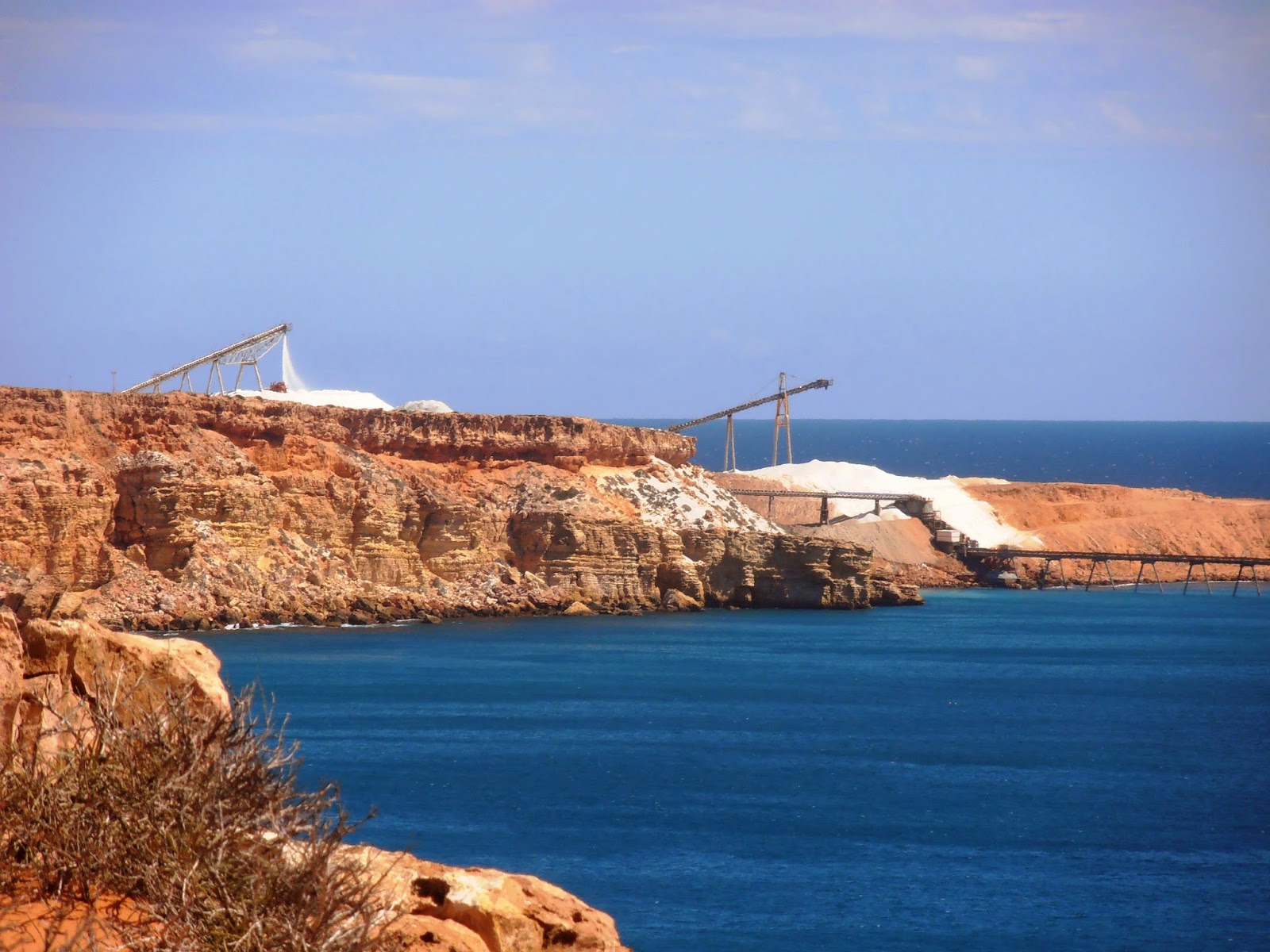 |
| The port at Pont Cuvier |
Soon we came over the brow of a rise and saw a land cruiser
parked on the side of the road, and nearer us, a women of a similar age to us,
hunting for something along the edge of the dusty route. We stopped and she
explained they had lost several nuts off their wheel and she hoped to find
them. In the meantime her husband was juggling those remaining to cover the
short fall and they planned to limp quietly back to civilisation, hopefully
without disaster. Unfortunately, wheel nuts are not something we carry, and had
we offered some from our own wheels, we would have simply shifted the shortage from
them to us. There was nothing we could do, and she assured us her husband was "mechanical”,
probably more so than us, so we left them to it.
 |
| Blowholes |
Speaking of “cattle grids”, we have frequently found
as we have travelled along highways where cattle roam free and far, that the
grids are simply white parallel lines painted on the road. This baffles us; are
the cattle so stupid they cannot tell the difference? I would have thought not.
We stopped again at the blowholes; I wanted to see
them from a slightly different angle and of course to take another twenty or so
photos. The wind had come up a little and with it the ferocity of the waves,
however in the big picture, Mother Nature was pretty subdued today. This would
be amazing to see in the big seas, but also very treacherous.
From here it could have been a clear run home,
however we decided to turn along westward on the northern bank of the Gascoigne
River in the hope of seeing some of these many plantations. I do believe this
word is used very loosely in the promotional literature, however we did see
many plots and a great variety of fruit and vegetables being grown, including
acres of outdoor tomatoes. We also noted that the stock and produce agents in
town must do very well out of selling shade-cloth. There are acres of orchards
and gardens under massive swathes of this beige screening.
We crossed the dry river bed on an alternative
crossing, a low concrete bridge that seemed in places below the river level if
ever there was water running. No doubt they close the crossing in such instances.
Back at camp I rinsed the sand from our togs and
then set myself under the awning to write this up. It is such a long time
since the temperature, the time and the absence of bugs have been in line to
allow such a practice. A great flock of sulphur-crested cockatoos have just
flown across the park, screeching the advent of sunset and Chris has just
returned from paying for another night. We rather like Carnarvon.
No comments:
Post a Comment