Tuesday, July 31, 2012

31 July 2012 - Boyds Bay Holiday Park, Tweed Head, NSW


The decision was made over the cornflakes, muesli and coffee, that we would move on and toward Murwillumbah to visit the art gallery, Tweed Heads and maybe over the border into Queensland. Soon after 9 am we were wandering about the streets of Mullumbimby, checking out the shops and those out and about. We had read that this town had undergone a transformation from a supplier of agricultural supplies to one echoing the buzzing of Byron Bay just down the road. Here it wasn’t the back packers but the colourfully dressed rasta-locked young who populate the cafes, the shops and the pavements. Here the young think nothing of squatting against the shop fronts chatting companionably with others of their kind; reminiscent of the ni-Vanuatu along the Port Vila waterfront. We picked up our daily newspaper then returned to the rig parked a few blocks distant.

Then we set off northwards along the Coolamon Scenic Drive, a route not even in our Tomtom’s databank; he repeated the “Turn around when possible!” command until we turned him off. We pressed on along the narrow winding sealed road, an alternative route back toward the Pacific Highway, through and over potholes, and dodging the oncoming cars and the overgrowth on the road side, through very beautiful scenery when we dared to take our eyes from the road immediately in front. Co-driving is as demanding as being behind the wheel.

When we did come down from the hills and emerge out of the bush, we were directed by our forgiven navigator along the Brunswick Highway and then the Tweed Valley Way, avoiding the freeway completely. We passed over the Burringbar Range, over some of the road we had been driven by Clarry way back in February last year, just as impressive now as then. Finally we came down toward Murwillumbah, to the Tweed River Art Gallery just three kilometres from the centre of town. Before leaving Mullumbimby, we had pulled out a couple of our travel books to check if there was any reference to opening times; there was none. So you can imagine our displeasure, to say the very least, when we discovered that the gallery was closed on Mondays and Tuesdays. We drove on down to the Information Centre and voiced our disappointment, engaging in lengthy conversation with a delightful man who once sold and serviced caravans. He drew our attention to the artist and his work in progress there in the Centre, a 360 degree view of the caldera from Mount Warning. It is a huge undertaking and the amount of work already completed is incredible. Completion date is November 2012; the pressure to complete in time probably accounts for the taciturn nature of the artist.

Barry directed us downstairs to where there is a wonderful collection of artwork, all part of a competition that was held recently. Much of it is for sale and had we had a wall large enough, I might have been tempted to suggest to Chris we purchase a magnificent painting of the root system of a gigantic fig tree. Lucky for him, and probably for me, there is no such space in our compact caravan.

As we came away, I did feel that we had not entirely wasted our time by travelling north via Murwillumbah, the road thus far, and that eastwards back to the Pacific Highway along the Tweed River is absolutely lovely, and today was the best of days to enjoy such scenery. It had been cold on rising, at perhaps about six degrees, however the sun soon warmed the day up and I was later envious of those wearing sandals.

We stopped at Stott’s Nature Reserve where we had camped one night last year, and found it as muddy as it had been then. It served as a quiet spot to have lunch and decide on our next move; to find a camp at Tweed Heads and collect mail.

The former proved more difficult and we had been warned, but we prefer to travel with a certain level of spontaneity, something that precludes booking ahead. Our first choice of camp was full, the second right next door equally so. We were directed to the council camp back along the river which is large and has 250 powered sites, and so here we are. It is a lovely camp and despite the huge number of sites, is nearly full. The sooner the weather allows for free roadside camping again the better however that depends on when we are willing to forgo the use of an electric heater in the evenings.

Tweed Heads with a population of about 52,000 is the most northern town in New South Wales, set at the mouth of the Tweed River just across the border from its twin town of Coolangatta. There are a couple of “main” post offices here in Tweed Heads, and as Murphy’s Law would have it, our mail was at the second one we called at, but it was there, and if you have followed this lengthy saga of ours, you will realise that this is worth celebrating.

We wandered about the shopping centre, checked out the ice-cream at MacDonald’s and then drove up to Point Danger overlooking the river mouth to the south, and up the coast to the high-rises of the Gold Coast silhouetted to the north east, in doing so crossing the border a couple of times, before returning to our camp back in New South Wales.

Monday, July 30, 2012

30 July 2012 - Mullumbimby League Club, Northern Rivers, NSW


This evening we are parked up adjacent to playing fields bounded by sugar cane, all beside the Brunswick River and the small town of Mullumbimby. This was not our intended camp for the night, however we found ourselves rejected at the Mullumbimby Showgrounds; it seems that campers are no longer welcome here. Perhaps this is a new innovation of all councils in the Northern Rivers area, having started at Murwillumbah last year and Lismore more recently.

Our departure from Lismore was uneventful; we were soon climbing eastwards out of the wok, passing through the hilltop suburb of Goonellabah and arriving at the riverside town of Ballina before we knew it.

Ballina lies at the mouth of the Richmond River, with a population of over 19,000. Obviously it is a place of substance so we checked it out before pressing on. We walked up and down the main street, noting that the Woolworths Supermarket was being rebuilt. It seems that there was a fire last Christmas, and work has just been started now on the rebuild in tandem with upgrades of the main street. We were impressed with the commercial centre of Ballina, with the esplanade along the river where we did not linger due to the cool wind, and even more impressed to locate all the supermarket chains not too far away in another shopping centre. There we bought fresh bread for lunch and headed north to Lennox Head.

This is pretty little seaside town of nearly 7,000 situated in a wide shallow bay of surf swept white sand. We were unable to find a suitable space to park the rig along the foreshore; the parking places are laid out to suit regular size cars. However we made our way along to Lake Ainsworth, an attractive freshwater lake with tannin stained waters from the surrounding tea trees. We were pretty much alone by the lake apart from the birdlife however we could not help notice the caravan park adjacent and imagined it would be an excellent place to stay should one wish to linger in Lennox Heads.

After lunch we continued on up the Ballina Coast to Byron Bay, a world famous seaside resort of a permanent population of not too much more than 5,000. Until 1963, Byron Bay was a quiet unassuming town, but then in that year surfers discovered “The Pass”, a gap between Fisherman’s Lookout and the headland, now the most popular surf break on the north coast.

There are actually seven different beachfronts here, so there is something for everyone if you like beaches, and for those who don’t, there are a mass of cafes, pubs, clubs, restaurants and everything that high spenders could possibly want.

Today it was backpacker types who seemed to crowd the streets, more than we have seen since Airlie Beach far up the Queensland Coast or Cairns even further north. They and the traffic on the roads had brought the town to a standstill, and had we not already been warned about this, we may have despaired. Lonely Planet says of Byron Bay: When Byron Bay is good, it’s very, very good. Long days, balmy weather, endless beaches, delightful accommodation, delectable food, rapturous nightlife. But when Byron Bay is bad, then let’s just say it’s crowded. Very crowded. But then let’s focus on those periods when the traffic isn’t so thick on Jonson Street that driving to the chaotic mess of Woolworths takes forever; let’s instead think about the qualities that make Byron the most desirable beach in NSW.”

A drive up to the lighthouse looked like just the ticket however half way up we were faced with a sign forbidding caravans further travel, so we turned back in frustration and made our way back on to the flat foreshore, delighted to find a parking spot. We walked out on to the extensive bay with its glistening white sand and watched the hang-gliders circling the cape, agreeing that this was indeed a fabulous beach for beach lovers. We returned to the cruiser and bravely faced the traffic chaos of Byron Bay before travelling on back to the Pacific Highway.

As we departed the area, we passed an intense police presence and then signs about a festival, then remembered the Splendour in the Grass four day festival featuring musicians such as Smashing Pumpkins and  Ladyhawk, names I am familiar with, had taken place over the weekend. We learned tonight on the news that the police had been disappointed to find 400 people with drugs over the days of the festival. Perhaps some of the festival goers had stayed on to enjoy the other attractions Byron Bay had to offer and perhaps that accounted in part for the unbelievable crowds, given that it is Monday, 30 July, the middle of winter.

It is less than twenty kilometres through to Mullumbimby from Byron Bay, west of the Pacific Highway so did not take long to reach. We headed straight for the show grounds and found this little town quite charming. It is apparently referred to as The Biggest Little Town in Australia, having a population of just over 3,000 and lies at the foot of Mount Chincogan, a peak we initially mistook for Mount Warning in the Tweed River area. It is here that the Sydney / Lismore / Murwillumbah railway line crosses the Brunswick River; the line having been opened in 1894 and then closed in 2004 because of an argument over funding between Federal and State politicians, despite strong community resistance.

Both the show grounds and the league club are listed in the Camps 6 bible, hence our seeking them out. We were disappointed to learn on checking in here that the tariff is $25, a bit hefty in our opinion for a camp such as this. There are several caravans and motorhomes established along the riverbank, the occupants able to step out their homes and dangle a line into the river from their awning chairs. We, along with a couple of others, are set up directly behind casual grandstands, with power and water. Tonight there are several teams in training under the lights however they will head off home soon leaving us to this otherwise peaceful park.

Our plans have been turned on their heads and all because we have arrived in this area at the beginning of the working week. We had hoped to call upon my ex and his wife at Murwillumbah, however Clarry, even at more than a decade older than the regular retirement age, is busier than ever with work and our ex-niece on the Gold Coast will also be tied to her work until the weekend. We have no desire to kill time until next weekend so will review our entire travel plans tomorrow. Fortunately the weather forecast for the next week and beyond is excellent. 

Sunday, July 29, 2012

29 July 2012 - Lismore Lake Holiday Park, Northern Rivers, NSW


Yet another day out of the box; how lucky we have been of late with the weather. After spending most of the morning attending to domestic matters, we set off for a walk to explore our immediate surrounds. The name of the camp alone suggests that we are close to a lake, and while this is true, the lake is “closed” and accessible to wildlife alone. Lake Gates is a ten hectare artificial lake that was excavated then filled with water from the adjoining Wilsons River in 1971. Three islands were constructed in 2004 to provide havens for the seventy five species of birdlife.

The camp here is, or was, a council camp and is immediately adjacent to both the lake and the river, as well as a manmade shallow pool that is perhaps cleaned and filled with water during the summer months. In the meantime it is a bit of an eyesore.

There is a boat ramp on the river bank, close to the rowing club, however the water did not look very inviting; a great mud coloured channel.

After lunch we headed back north along the road we had come back on yesterday, up through Dunoon, which is known as the Macadamia Capital of Australia. We learned earlier on our tour that macadamias are native to Australia. New Caledonia and Indonesia should be added to that list.

It was interesting to read that the first commercial orchard of macadamia trees was planted in the 1880s twelve kilometres south east of Lismore. Today it seems the concentration is twenty kilometres north at Dunoon. From the road, the rows of macadamia trees of differing ages stretch for as far as the eye can see. There are numerous factory setups for the extraction of oil and whatever else they do with the crop.

Just a few kilometres northeast we found Rocky Creek Dam, the primary water supply not only for Lismore, but also for Ballina, Byron Bay, Evans Head and Alstonville. The dam was built in 1953 and the reservoir covers an area of just two square kilometres or 478 hectares. There is a wonderful picnic area along with a few walking tracks we decided to explore.

Soon after setting out, we spied an echidna snuffling about a pile of sticks. Once he realised he was under scrutiny he decided to play possum. We came up close to this creature burrowing under the wood, and did get a good look at his long multi-coloured spines. It was the first time I had seen a live one in the wild; naturally I found that quite exciting.

We continued on, crossing the dam and on to the spillway where we had to rock-hop to cross the creek. We scrambled up the other side of the steep bank but were unable to find the track.  Twenty minutes later after pushing through regenerating bush, nearly falling into brush turkey nests, getting caught up in nasty bush lawyer vines, we were still lost; well not us, but the track. We gave up, scrambled down a muddy overgrown bank, made our way back up river to where we had crossed previously and headed  off on another track, this time down to another creek backed up and beautiful under palms and other trees standing tall over the water, reflected in the deep pools that hid platypus. The track continued across the creek on a bridge closed for safety reasons which we crossed one at a time with caution, uneventfully, and finally arrived back at the picnic area, unscathed and marked only by mud.

We decided that was enough adventure for one day and returned to camp where Chris washed the mud gathered from the last two days off the cruiser and we sat over travel literature to consider our next move.

Saturday, July 28, 2012

28 July 2012 - Lismore Lake Holiday Park, Northern Rivers, NSW


No doubt we were just two of many billion who watched the opening of the 2012 Olympic Games on television this morning. It seems that having no access to pay-tv will be no disadvantage after all. Of course for us here in Australia on the east coast, it was nearly 10 am by the time everything wound up, so our day’s adventures started no earlier than normal despite an early waking.

I wanted to go to Nimbin and had wanted to do so since I first heard about it last year when we spent time with my older son’s father. Clarry told us all about this oddball place where hippies hung about smoking dope and police turned a blind eye. There were many more amazing descriptions of the place, many sifting through over the intervening months from travellers met on the road and so with us here in Lismore, just thirty kilometres away, the opportunity presented itself.

Nimbin is called many things; amongst the many, the drug capital of Australia and today as we wandered about the busy or rather, crowded streets, I just about got high on second hand cannabis smoke. Locals were sitting about dragging on their joints, not at all discreet, however we had been warned we were likely to be approached by sellers; we were not. Do I sound disappointed? Perhaps a little, however I would have graciously declined any such offer.

Nimbin Roacks
We travelled up to Nimbin following the Goolmangar Creek, through such a pretty valley, passing the Nimbin Rocks, a series of jagged outcrops, solidified plugs left after the erosion of volcanic dykes and vents. This sacred site has restricted access however we stopped by the roadside just south of the village to admire these towering natural structures.

At the risk of repetition, it was the red cedar that drew the first non-aboriginals into the area in the 1840s. In 1903, with the forests all gone, the land about was subdivided for dairying and banana growing, then in the 1960s, the local dairy industry collapsed due to the recession and Nimbin went into serious economic decline.

In 1973, the Aquarius Festival was held in the village bringing mainly university students from Canberra, among the mix of hippies and party folk. This festival was the first event in Australia that sought permission for the use of the land from the traditional owners. After the festival, hundreds stayed on to live the dream and ideology of Aquarius and to sow the seeds of today’s vibrant and sustainable, if not slightly druggy, culture. Writers, artists, musicians, actors, environmentalists and permaculture enthusiasts followed.

In 1979, the Nimbin community staged the Battle for Terania Creek to protect remaining local rainforest. This and subsequent protest action led to the change in government logging policies and the establishment of the Nightcap National Park.

Before the bottom fell out of the dairy industry, Nimbin had a population of just over six thousand, in 2006 the population was 352, however that latter figure does not include the many Multiple Occupancy rural properties, the hippy communes of which there are many all about. Another analysis of that same 2006 census suggests that Nimbin serviced a further ten thousand,  living within fifteen kilometres of the village centre. Needless to say the unemployment rate was high, up about 18% and by now surely worse.


Sights in Nimbin
Despite the fact that cultivation, selling and possession of cannabis is illegal in New South Wales, all three activities are an everyday part of the culture, celebrated even more in the annual Mardi Gras where events such as the Prohibition Protest Rally, Parade with the Ganja Faeries, the Nimbin Cannibis Cup, the Hemp Olympix featuring joint rolling and bong “Throw’n Yell” add to the fun and frivolity.

We called into the Hemp Embassy where you can learn that the drug is quite harmless, in fact hemp itself is a wonder commodity in so many ways. Here you can buy hemp products of all kinds, including stash tins, but not, alas, cannabis itself. That is left to the locals wandering about with their own home-grown attempting to supplement their dole money.

Next door to the Embassy, one can buy hemp smoothies and hemp burgers; the mind boggles. I am sure that the many other cafes offer similar delicacies.

Apparently police intervention has fluctuated over the years, swinging from full scale raids as in 2008 when 110 officers equipped with bulletproof vests, horses and dogs descended upon the village, to simply remaining absent. I guess that these funny folk of Nimbin are not really doing any harm although I do wonder about the children being raised in this culture.


We found ourselves in an old building packed full of books and other second hand bric-a-brac, watched over by a woman of about our age, sitting in a dark corner combing her long grey locks.  She came for the festival all those years ago, and bought into one of these multiple occupancy properties, previously a 730 hectare dairy farm, at Tuntable Falls. We understand that the shares cost about $200 at the time, and today she might sell out for what someone might consider her still unfinished house to be worth. The occupants consider that the land is owned by the aborigines and that they are mere custodians, owning only their own few sticks of timber they call home. Over the years the community established a primary and pre-school, a grocery store, a hall and a derelict building in Nimbin which houses a cafe but no real wealth in the way we on the outside would measure it by. As she continued to comb her hair, this woman lamented the cost of contributing to the Mardi Gras, the 40th Anniversary of Nimbin’s Aquarian life next year, the cost of finishing her verandah, of upgrading her power source, and confessed that she, as most there, were deep in a poverty trap. And the very sad fact is that those who came at the beginning were most likely some of the brightest stars of the future and they messed their lives up all by themselves. And who picks up the bill for all this? The Australian taxpayer, of course.
Walking up to Protester Falls

However for all that, we would encourage travellers to make the journey to this very colourful village, full of wonderful wares for sale, including beautiful bright clothing from Nicaragua and India, jewellery and pottery, and all manner of other giftware and crafts. And it feels so genuine, as if you have truly stepped back into an alternate space in the 1970s. The buildings alone are a sight to behold, all painted if worn with bright cheerful murals and psychedelic colours.

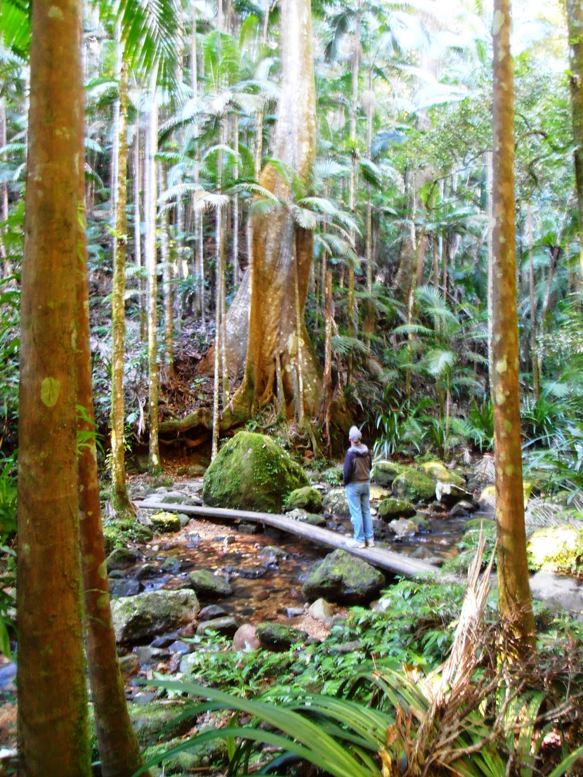
We drove on to The Channon, another village nineteen kilometres south after climbing east and over the ridge from Nimbin. This village is very small, with a general store, a tavern and very little else, however manages to host a monthly 250 stall market which draws ten thousand people from the region. This astounded us because we were unable to find even a picnic table or proper public area where we could enjoy our picnic. We took advantage of the one grassed spot in front of the store then headed north again, a further nineteen kilometres winding up the Terania Creek valley into the Nightcap National Park, along the narrow muddy road. Here we parked and walked up the creek to the Protester Falls, just 1.4 kilometres from the car park. The track passes through a forest of bangalow palms with just a few buttress rooted towering trees; an absolutely beautiful walk up past the cascading creek and finally arriving at a high cliff over which the falls plunge 100 metres into an inviting pool. Swimming here is forbidden; fragile Fleay’s Barred frogs may or may not inhabit the creek. The falls are so named because of the protest against the logging referred to earlier.

We were glad to have made the effort, but now decided we had absorbed enough for one day, and so headed back for Lismore, this time travelling directly south through Modanville and Tullera, lovely open land growing mainly macadamias. As we came back through The Channon, we did come upon a communal park area further south which evidently is the location for the grand market.

Back in Lismore, we popped into MacDonalds for ice-creams to celebrate the sunshine then returned to camp. I prepared a pork roast for dinner while Chris climbed on to the roof of the caravan and re-painted the airconditioner.

Friday, July 27, 2012

27 July 2012 - Lismore Lake Holiday Park, Northern Rivers, NSW


The rain had cleared by morning however the weather was forecasted to improve even more in the days ahead; we decided to hang about Lismore itself for the day.  

The Bunnings hardware warehouse is just up the road and always a man’s paradise even if nothing is needed; a bit like a lolly shop for the regular guy. We did need several items and before we knew it, our basket was full and the till strip was long; cans of paint for rust already appearing on the jerry can holders (not so great after all, Paul Winmill) and for the airconditioner still needing touch up, along with wire straps to secure the jerry cans.

In following with our normal practice, after spotting the word Lookout on the map, we found our way up to Robinson’s Lookout on Girards Hill, to get our bearings. This must be a pretty place in the heat of the summer, to picnic in the shade of the tall trees all about, especially if the council gardeners have recently been. For us today, it offered nothing but a wilderness for creepy crawlies and impossible views; a Clayton’s lookout.

We called into the Information Centre again and chatted at length with the same very friendly assistant I had dealt with yesterday, coming away with a good idea of where and what to do over the next few days. Our first port of call was the Lismore Regional Gallery, housed in a rather small two story building. According to general descriptions of this gallery, their collection includes works by Margaret Olley, Brett Whiteley, Patricia Piccinini, all of which I was keen to see. Instead the three small galleries open to the public today were exhibitions which in our opinion fitted well with the suited pretentious prats posing as curators rushing about the place:

1-      An art project titled Survivor by contemporary Indonesian-Australian artist Dadang Christanto, centred around the hot volcanic mud that wiped out eleven villages and destroyed many lives in East Java.  A film of models holding pictures of victims of the environmental disaster standing on a muddy set just doesn’t do it for me.

2-      Leonie Lane’s work titled Bananas, Business and Bocce – The Lismore Italians is a memorial to the migrants to the area. Digital prints adhered to the walls and random exhibits like a pair of old shoes, a table and chairs and a few descriptions here and there might be better suited to a museum rather than being described as art.

3-      Fiona Foley’s Bliss is a film showing pretty poppies blowing in the breeze apparently representing the history of the 1897 Aboriginals Protection and Restriction of the Sale of Opium Act. Deadly obscure to the likes of us, but then it all comes down to the fact that neither of us as a degree in Art appreciation and so what would we know?

In fact, I really wonder why I even bothered to record the above when it pleased me not at all? Perhaps as a warning to any who might be wondering whether it is all worth the effort.

Needless to say, it was a delight to find ourselves in the nearby museum administered by the Richmond River Historical Society, open five days a week. Fortunately for us, today was Friday and the doors were open. Here we discovered really good exhibits of all matters pertaining to Lismore and the Richmond Valley, particularly impressed with those relating to the waterways and the timber-getting.

Lismore is 125 kilometres up river from Ballina on the coast, or thirty five kilometres by car today. The Wilson River which is joined by the Lycester Creek here at Lismore, flows south to join the  mightier Richmond River; Lismore being the furthermost navigable port. In 1845 a couple by the name of Wilson took up land here and named their station Lismore after an island in Scotland they had visited on their honeymoon. This is a particularly delightful gem when you see a photograph of this couple taken in their later years. But then we all looked attractive in our youth and one should exercise one’s imagination more.

The town of Lismore was established on this site in 1856 and incorporated as a municipality in 1879, later proclaimed a city in 1946.

The river which had been useful as a highway for the timber, much of which was rafted down to Ballina, and for the export of agricultural produce, was also the bane of people’s lives. Floods fill the great river basin, or wok as the girl in the Information Centre described it, on a fairly regular basis. The worst one in more recent history occurred in 1974, but it was not until 2005 that flood banks were constructed to withstand all future such deluges. Just weeks after the levee was completed, the river threatened to submerge the town once more and 9,000 residents were evacuated. It proved to be a false alarm although did test the efficiency of the SES. However the banks are lower than the flood level of 1974, so it just a matter of time until history is revisited.

We retreated to a well-manicured park by the riverside and ate our lunch, listening to the loud cries of the crows in the trees above, and then returned to the CBD and wandered about this very busy city. People were everywhere, most of the shops busy with customers and even when we found the Coles supermarket in the Lismore Shopping Centre at some distance from the centre of the city, we found that too busy with shoppers.

It was still only mid-afternoon when we returned to camp; I set about cooking a big batch of spaghetti bolognaise sauce and Chris pottered about installing and working with his earlier purchases.

Thursday, July 26, 2012

26 July 2012 - Lismore Lake Holiday Park, Northern Rivers, NSW


The birds did indeed start early and herald yet another sunny morning. We headed out from camp before 10 am and headed north to Woodburn, a small town of less than a thousand inhabitants, situated on the Richmond River which started its life, unsurprisingly, as taking part in the red cedar rape. Perhaps I use that term carelessly however I do recall somewhere far far north of here, descriptions of the desecration of the Australian forests by those who came for the cedar, and so it does seem appropriate, at least to me.

Anyway, here we turned eastwards and headed the ten kilometres to the coast, to Evans Head. The Lonely Planet does not speak very kindly of this seaside settlement of just 3,100 folk, which survives on tourism and the prawn industry, however we found it to be absolutely delightful and the pick of many of seaside places we have called into over the past month or two. Yes, it may be sleepy, and have a rather modest cafĂ© culture, but for us that makes it all the more attractive. We wandered along the northern bank of the river and out to the breakwater, to view the rather treacherous entrance, so much so that neither of us fancied venturing out to sea, even on a calm day like today. We did toy with checking in to the caravan park for a night or two, but then decided Evans Head was probably better suited to us if we were in need of a couple of day’s recuperation, such as we did in Normanton when I was sick last year. For the traveller there is walking and fishing; we enjoyed a little of the former and left the latter for those already settled in. Instead we drove across the river to the southern bank where the idle commercial fishing boats were moored and ate our lunch after another short walk. There we saw the manmade sea-eagle nest high up on a seventeen metre pole. Apparently with so much vegetation being stripped by those who have come even after the timber-getters, the ospreys must rely on such constructions. This I do not believe however there was an eagle in residence on the metre square platform which proves that if you offer hand-outs, they will become expected.
Fishing boats at Evans Head
And so after deciding that Evans Head would be worth checking out again sometime, or recommending to those who wanted somewhere peaceful to stay, we headed back to Woodburn, and took the road up here to Lismore.

Now this is a major road, sealed all the way; the road any normal person travelling from the south along the coast would take to reach this regional centre, but what a road! Uneven surfaces, subsidence, all that we have come to expect and worse! In fairness there were road workers busy on sections and some small sections that had been resealed, but the fact remains that it is appalling for roads to ever reach this state in the first place. Oh dear, I am back on my soapbox!

It was our intention to stay in the Lismore showgrounds, advertised in the CMCA bible, albeit last year’s edition. We allowed Tom-tom to take us across the city and out under a rail bridge so low that I hopped out to check we would fit under it, only to find the gates locked, no sign of other campers and looking most unwelcome indeed. So back into town we went to the Information Centre where the very friendly assistant gave me a map and a list of caravan parks, and advice that the tariffs were not available to the Centre.

The camp is on the Bruxner Highway on the way to Casino, opposite the airport and is not greatly patronised by casual travellers. The facilities are clean and very acceptable, the trees are numerous and the birds likewise. Our only fellow travellers are holed up in a Lotus, so I figure that likeminded discerning caravanners stay here. Their van is one of the more modern numbers, with the exterior in that grey steel colour which has become all the rage. Like us, they purchased their caravan at Woombye, but unlike us, seem to have had bad luck. Apparently the gentleman backed out of his drive without seeing a rather sturdy power pole and the damage to the exterior and the gas water heater is there for all to see. Perhaps they are not seasoned travellers? Perhaps we will make their further acquaintance tomorrow? In the meantime we are also holed up inside with the torrential rain dancing a din on the caravan roof. It will pass and hopefully tomorrow we will explore this city of 30,000 people and the surrounds where a further 15,000 live.

Wednesday, July 25, 2012

25 July 2012 - Woombah Woods Caravan Park, Clarence Valley, NSW


Merry Christmas! It seems that here in Australia that those who celebrate a winter Christmas do it in July rather than in June as their cousins across the Tasman do. It all seems very silly to me but then I was never one for spontaneous madness. I cannot remember this happening last year but then perhaps we did not sit glued to breakfast television then as we seem to do these days.

Despite an early rising, we hung about until 10 am for our appointment with Paul Winmill Caravan Repairs, to have the jerry can holders welded to the caravan bumper bar. I use his full business name here rather than any anonymous half reference because he gave us his card and a couple of stubby holders with his name emblazoned all over them for promotional purposes, and we were well pleased with the service.

We were back on the road before 11 am and headed down river along the southern bank, keeping to the Pacific Highway until we reached Maclean. This lovely riverside town of about 3,500 people was officially laid out back in 1862 and named after the Surveyor-General, Alexander Maclean. Sugar and fishing have given the town its wealth over the intervening years, and for the last one hundred years it has hosted a Highland Gathering every Easter. The Scottish theme is not only embraced by the one Scottish Shop, but by every business in town. The power poles down the main street are all painted with a wide band of the various highland tartans; Armstong, Alexander, Fraser, Maclean, McLaughlan and so on. There is nothing pretentious about Maclean, in fact it seems to have its fair share of losers; the courthouse was busy and all the supporters of the “customers” were enjoying fish and chips beside the river.

With the aroma of those same fish and chips in our nostrils, we stood for a while on the jetty and watched a lone pelican cruise around scoring the odd fish, but otherwise just looking so graceful gliding about to impress us.

We walked up and down the main street, then had lunch parked beside the flood bank that may or may not protect the town from future floods. Floods have been a regular feature of the town’s history, however when one travels about this whole lower Clarence area, it could not be otherwise. We thought Maclean just delightful, but then most places glistening in the warm sunshine are attractive to the relaxed traveller.

From here we drove west to Yamba, a seaside settlement, currently with a population of over 5,500 and still growing, probably with baby boomers moving into the lovely modern houses springing up on the river flats. As with most tourist destinations, the population triples over the summer months.

Yamba had been recommended to us, although I cannot remember in what context. We drove across the many flat islands, linked with low bridges across the many channels.

The town’s economy is strongly based on fishing as is Maclean’s, as well as tourism. There were dozens of commercial fishing boats lined up across the river from the waterfront, but as there seemed little space for cruising caravans except for the welcoming gateways of several camping grounds, we drove on through and found our way up the hill to the sea coast. There are some very fine houses all along the elevated part of the town as there are in most such places. For ourselves we cannot understand the appeal of living with a monotonous view of the sea horizon, although this one is no doubt broken from time to time with the excitement of passing ships and humpback whales.

We found a space above Pippi Beach, apparently where one can dig for pipis, and gazed northwards to what we thought to be the heads. Driving further up the road, we found ourselves near the lighthouse, and here we did walk to the heads, high above the mouth of the river, channelled through long rocky break walls and flanked by popular surf beaches. These very same beaches play host to an annual surf festival, the “Surfing the Coldstream Festival”.
The lighthouse at Yamba

We left Yamba by the same route we had come, still debating how far we would travel on and where we would overnight. We decided to make our way to the first of our planned possible camps, back on to the Pacific Highway, across the southern arm of the Clarence River, past the Harwood sugar mill, across Chatsworth Island, across the northern arm, then just a little way up the road to Iluka. We pulled into this camp just a few kilometres short of Woombah and were wooed by the woods of the camp.

So here we are, only one party of two casual campers, the rest all permanents. The birds here are very numerous, in fact, we are told that city slickers complain about the kookaburras’ wakeup call; I can hardly wait. Up at one end of the camp there is a collection of bird baths and feed stations; we watched a dozen gloriously vivid coloured parrots cavort oblivious to our presence. Arriving early has given us even more time to enjoy this lovely spot. 

Tuesday, July 24, 2012

24 July 2012 - Grafton Showgrounds, NSW


Yet another day of good weather; how good is that? In fact, as we sat under the awning at lunch time, I saw the thermometer read 24 degrees in the shade, we are still over 300 kilometres south of Brisbane and we are in the last week in July!

Cattle grazing near sugar cane
After I had made another batch of milk up, prepared the corned beef for cooking all day in the slow cooker and pegged a load of washing on the line, we set off with lunch packed in the eski for a day’s touring. We headed north east, down river, crossing river flats alternatively grazed by beef or dairy cattle and planted out in sugar cane. Reaching Southgate, a locality rather than a settlement, we pulled in closer to the river and watched as the car ferry dispatched its load of vehicles and took on board those queued along the creek. Here the ferry comes right up into a creek off the Clarence River but on the other side appears to spill its load straight on to the Pacific Highway. The ferry here, like others we have come across on the Hawkesbury close to Sydney and on the Murray up near Renmark, is all part of the state road system and as such is free to users.

We continued down river until we reached Lawrence about thirty kilometres from Grafton. The official population is a mere 390 people, and yet there is a general store, a school, Post Office, Police Station, tavern, museum, a cricket field, soccer fields, a golf course, a public hall and a really good feel about it. There was little to keep us here and the ferry that crosses the Clarence here was at the time of our arrival undergoing maintenance, so we carried on, travelling north west this time, over hills clad with eucalypt bush, intercepting  the Summerland Highway which runs from Grafton to Casino. We turned south on to one of the best roads we have travelled here in New South Wales, returned to Grafton and were back in camp less than an hour and a half from departure. Needless to say our lunch was unpacked and we picnicked at home.

Early afternoon, we set off on foot down into the centre of Grafton and found our way to the Grafton Regional Gallery which is set in Prentice House, built way back in the 1880s. While we would not put a visit to the art gallery here as a must-do, we were pleased to have made the effort. The exhibits included Robyn Tychen’s “Secret Women’s Business”, brightly coloured studies of women in their toilette, all quite charming, a collection of photos, paintings and other media titled “The Horse: Art & Science”, sourced from a variety of collections, both private and public, the entrants to the Parliament of NSW Aboriginal Art Prize 2011, and a collection of photos by John William Lindt.

Lindt, a real eccentric by all accounts, took some significant photos of aboriginal people around 1873. Not only are these sepia records of artistic merit, they serve well as an historic record of the people of the time.  There was an informative DVD playing in the gallery about this man and the one fact that stood out as memorable was the story of his final demise. Lindt spent his late years near Healesville in Victoria, living and entertaining in The Hermitage he built at Black Spur. The property was set amongst the bush, surrounded in tree ferns and sassafras and all the other vegetation I grew to love in Victoria. In February 1926, bushfires consumed the bush all around The Hermitage, one of the great joys of his life. Then having survived that, he promptly up and died within two days, at the age of eighty one. Hardly fair, I would have thought.

Upstairs we found ourselves in an exhibition titled “I spy with my little eye, something beginning with….”, an exhibition to enchant and educate children. Most of the work was interesting to us, but what I really liked, given the theme of the exhibition, was that the plaques detailing the artist and the title of the work, and then a small story and question, were all placed low on the walls as were the works themselves. While it did not make it very easy for us adults to read or even view the work without bending down, it made the art work more attractive to junior would-be art connoisseurs.

We walked back home, calling into the Aldi supermarket to pick up a few well priced items, then on paying, the checkout girl insisted my handbag be searched. She obviously mistook my fatigue for shiftiness; lucky I was too tired to convey my disgust.

Monday, July 23, 2012

23 July 2012 - Grafton Showgrounds, NSW


Hopefully we will continue to enjoy weather as we have had today. After watching highlights of the final stage of the Tour de France on television, mourning the fact that no Australian (or even Kiwi) had scored any of the crowns and celebrating a break from sport (for at least a few days) over breakfast, we set off down into Grafton’s centre and walked about the streets to see what we could find.

Grafton, today with a population of about 17,500, is located on both sides of the mighty Clarence River. It was established in 1859 and declared a city in 1885. Originally known as “The Settlement” and “Woolport” and now known as South and North Grafton respectively, the two settlements were linked in 1932 by the current double-decker road / rail bridge.  The bridge, is one of a kind and is a major feature on the Clarence River in Grafton.

Just like most of the other settlements up and down this part of the coastline, Grafton was first opened up to white settlement by the cedar-getters. A convict, escaped from Moreton Island (up Brisbane way), discovered the district and the Big River, later named the Clarence, in 1831. He found wandering cattle and figured out they must have strayed from the settlement at Port Macquarie. Returning them and expounding the virtues of the river further north, he was handed a pardon for his efforts.   

Late in the 19th century some far thinking chap started planting jacaranda trees about the township and today the annual blooming of these superb trees is celebrated in a great festival. Alas we are about four months too early although driving around today we could well imagine how the city must look through October and November; there are jacaranda trees everywhere.

The Clarence River rises in the McPherson Ranges just north of the Queensland border and flows for over 400 kilometres, through to the sea at Yamba. At Taree we learned that the Manning River Delta is the only one of its kind in Australia, and yet the descriptions of this region use delta to describe the river here. Perhaps this incorrect use of the word arises from the fact that there are apparently over one hundred islands from here to the coast formed by the river as it meanders through the fertile farmland.

Grafton also marks the start of sugar cane country and the beginning of the Queensland-style domestic architecture; wooden houses with high pitched roofs perched on stilts to allow air circulation in the hot summers. Today as we drove about, we did see many of these wonderful houses interspersed with a variety of modern and just downright shoddy dwellings, however as far as the sugar crops? We saw none but did note a sugar shed beside the rail line.

In town today we sought advice from cycling experts, having nothing to do with the Tour de France but instead to questions and discussions that have been swirling within our partnership for several weeks. Over the past eighteen months of travel, there have been many times we have regretted not having our bicycles with us.  When we returned from New Zealand at the end of June, I bought back my Sarah Ulmer cycling pants in readiness for future cycling expeditions, however the challenges have been not about what sort of bikes, or how much to spend on them, but how to carry them. Bearing in mind that our landcruiser’s doors open out from off-centre at the rear, that our drawbar is not as long as some which can accommodate bikes and a multitude of other loads, that we have been warned against carrying bikes on the roof rack of the vehicle or on the back of the caravan, we were in an absolute quandary. The chap in the Jayco dealers in Coffs Harbour suggested folding bikes and almost sold us a couple before we decided to do some further homework.

Further investigation, checking out online forums and chatting with the likes of these very friendly and helpful chaps today, decided us that folding bikes were not for us and the plans we had or thought we had. But then we were no nearer arriving at a solution of a carrier. Over coffee this afternoon on our return, we decided to give the whole bike idea a miss and continue to enjoy Australian cycle trails the same way we have so far; on foot.

And then after arriving at that final decision, a camper came in with a very interesting rack mounted on the rear of their vehicle. And so the problem was revived and we will muddle along with the whole matter still unresolved.

Today I also picked up a copy of George Elliot’s Middlemarch which was subject to a column in the Australian Review on the weekend. Apparently my life will not be complete until I read this rather wordy 700 page novel. So much to read and so few years to do so!!!!

And for something different we checked out the Anglican Cathedral, built in 1884 which features impressive vaulted ceiling and a host of lovely stained glass windows.

After lunch we set off out again, this time south across the river to find the Grafton caravan repair  man to organise the welding of our new jerry can holders onto the back of the caravan. This will be done on Wednesday morning as we leave the area.  

We then drove into the centre of South Grafton, walked up and down the main street and noted the drinking and drunk black, white and brindle people either hanging about or attempting to make their way from A to B. We purchased some local potatoes from an excellent greengrocer. There are pubs and printers and one of those shops full of occult paraphernalia where one can have their cards or fortunes read or perhaps link up with dead relatives from the other side. Both the red and the white poinsettias were in full bloom, as are the pyrostegia vines bright with their glorious orange flowers, but alas the township of South Grafton did not impress us much.

Not wishing to hang about too much, we set off along the road toward Glen Innes, turning off the Gwydir Highway a few kilometres out and travelling north through Waterview Heights  and Seelands which we thought might be interesting. These very rural rolling hills to the northwest of Grafton are home to those who enjoy living near Grafton, but not in it, and prefer the company of kangaroos, snakes and the birdlife that surely must abound, along with the odd horse, to the inhabitants of Grafton.

We crossed the Clarence River on a long low concrete bridge and headed back along the northern side of the river back to Grafton. We made a point of driving past the Greyhound Club, which like the Showgrounds, offers good value camping. While this second camp is further from the centre of town than the showgrounds, it is quite attractive and the buildings around the racetrack do not share the derelict nature of those at the showgrounds.

Despite any negative impressions expressed, Chris and I like Grafton and have found the people here just wonderful, or at least those we have engaged with in shops and services industries. The couple of sisters who are camped next to us have spent a week here and are still having a wonderful time. We booked for three nights; perhaps we might be encouraged to stay longer?

22 July 2012 - Grafton Showgrounds, NSW


Its cooler this evening; Chris suggested greater elevation being the cause, however on checking, not so at all. Grafton, according to the Wikipedia spiel, is a mere five metres ASL. That certainly explains why the Clarence River flows wide and sluggish here but not the cooler temperatures.

This morning we left Coffs Harbour amid squally showers and travelled northwards along the coast , the rain obscuring most of the views we might have otherwise had. Road works dominates the road from Coffs Harbour and even south, through to Grafton. We have seen the dotted lines marking the proposed bypasses on our maps and while these may be to the dismay of those with commercial establishments alongside the existing highway, it will certainly make the trip along this part of the coast a whole lot faster, and of course avoid the patchwork highway that travellers must in the meantime endure.

Woolgoolga, just up the coast from Coffs Harbour, with a population of about 4,500 is promoted as famous for its Sikh population. It is certainly true that two rather ornate Sikh temples dominate the entry both in and out of the seaside settlement, and just short of 10% of the population are of Punjabi birth or descent, however the earlier settlers do not see their township that way at all. Given that banana growing still dominates the agriculture of the coast region, one might imagine that Fijian Indians owned the 90% of the banana plantations, however as referred to above, these Indians are not those who long ago left their continental roots via the Pacific Islands, but those who have come by a more direct route. Their immigration does not go back that far, but is in fact all within my lifetime. It was during the 1960’s that these people came to make their fortune as so many new immigrants have done so.

The man in the Information Centre who may well have ethic roots similar to my own was adamant that Australians (such as he) were no less productive and committed to building the future of this country or even this part of the coast, or any less note-worthy. We left the Centre under the impression that he and his ilk would have written the promotional material for Woolgoolga with a very different slant to that which we have obtained in the preceding days.

It is only seventy or so kilometres from Coffs Harbour through to Grafton, and so we arrived before midday, but not so early as to allow ourselves time to set up camp and then have lunch without pressure of time. Instead we found our way through to Corcoran Park down on the banks of the Clarence River, a lovely spot with views of Elizabeth Island, before making our way to this showground campground. 

Our camp at the Grafton Showgrounds
The camping spots here are situated snuggly around the speedway track. Tonight there are about eight caravans and motorhomes in to share the very basic facilities however the price is right and that is what motivates most of us likeminded campers.

The kookaburras here are so very noisy, even more raucous than those of Dorrigo; one cannot help but also laugh to join their own laughter, so notable that it is even included in their very name. We are looking forward to exploring this rural centre apparently the first inland rural centre of New South Wales. (But didn’t we read that about Bathurst?)

Saturday, July 21, 2012

21 July 2012 - Harbour City Holiday Park, Coffs Harbour, NSW


It was such a promising day, I rushed along to the camp’s laundry with a couple of loads this morning and got caught up chatting to a fellow gypsy, Bev, from WA; Western Australia to purists or me until this abbreviation starts slipping from my lips like a native. She is a little more seasoned than I; she and her husband hit the road in 2009, however I sensed a real affinity with this very pleasant woman and will regret the brief acquaintance as so oft happens. We chatted so long that Chris came looking for me, which was just as well. I was longing for my breakfast and lunch time seemed to be fast approaching.

While the day offered opportunity for a driving tour, we had business to attend to before more trivial pursuits, however once we had sent off several emails and passed the baton back to others, we set out in the vehicle, firstly to the art gallery then the Park Beach shopping centre to enquire against all common sense, after my late watch. It would seem, as expected, that some lucky little Coff has discovered a lovely little gold watch, the inner-side plating slightly worn, battery still pumping and only a month old, with a dodgy catch. Good luck to them!  I have a new one! Complete with buckle and strap; I am happy once more.

After lunch we took a drive up to Sealy Lookout at the top of Bruxner Park, up through a narrow valley all planted out with banana palms and avocados, through eucalypt forest at the top and suddenly found ourselves beside the Forest Sky Pier, a lookout extending twenty one metres over the forest floor fifteen metres below. The township and beaches of Coffs Harbour are all laid out below and impressive; we now understand where the 60,000 inhabitants live. Rain was coming in from the east and we scurried back to the car, then descended the winding road, hoping to pick up some bananas from one of the many roadside stalls. We had seen them advertised with excellent prices; two kilo for $2 and I wanted to buy some Coffs bananas even if Chris was still sticking with his principled no-more-bananas-after-the-rip-off-last-year. Alas the only produce actually in the boxes were avocados and I am still waiting for those purchased at the market in Port Macquarie to ripen.

We stopped in at The Big Banana, an amusement park all about … bananas, of course. There is a water park, toboggan, ice skating, a gift shop, cafĂ© and a banana educational tour. It was all so very corny and kitsch, in our opinion, however I do appreciate that the owners have gone to huge efforts to build and establish this successful tourist attraction and good luck to them. I did offer to take Chris’s photo in front of the big banana and post it on Facebook. He declined the offer.

Back in Coffs Harbour proper, we parked at the North Coast Regional Botanic Gardens and wandered through this lovely park covering twenty hectares bounded by Coffs Creek on three sides. We walked a kilometre on the main pathway to the point through a variety of themed gardens, filled with trees and plants from all over the world, then returned along the creek side path, before heading back to camp.

We shall miss the friendly camp ducks, the flocks of parrots and other birds which abound here, however tomorrow morning the road will call again and we will head north once more.

Friday, July 20, 2012

20 July 2012 - Harbour City Holiday Park, Coffs Harbour, NSW


Somewhere in our travels today, I lost my watch. It just fell off my wrist! I am not happy, which is a real shame given that the rest of the day, while bitsy and filled with shopping and walking was really quite pleasant. It is not a terribly valuable watch but was given to me as a birthday gift some years ago by my beloved, hence my distress and anger.

During our walk into the town centre to check unsuccessfully for mail at the post office, we visited the Coffs Harbour Regional Art Gallery. There we viewed works by three separate artists and while we agreed that two of them definitely had skill, we also agreed that we could have easily given the gallery a miss.

Sadly the Regional Museum is still under repair from past flood damage; we would hope that would be more of a draw card to future tourists.

We have extended our stay here beyond the initial couple of days, and in doing so loose our discount but gain a free day. Being so central means that the Pacific Highway is close by; today we found the convenience excellent as we darted from one end of the town making enquiries about this and that. Which also means that my watch could be just anywhere! Oh woe is me!